
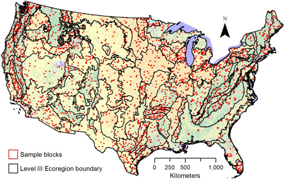
Map of Land Cover Trends sample blocks
By Western Geographic Science Center
2001 (approx.)

Detailed Description
Map showing the locations of the 2,688 sample blocks that comprise the Land Cover Trends dataset. The red squares indicate locations of the 10 km x 10 km and/or 20 km x 20 km sample blocks. The base map is the 1992 National Land Cover Dataset (Vogelmann and others, 2001).
Sources/Usage
Related

Land Cover Trends
Land Cover Trends was a research project focused on understanding the rates, trends, causes, and consequences of contemporary U.S. land use and land cover change. The project spanned from 1999 to 2011. The research was supported by the Climate and Land Use Change Research and Development Program of the U.S. Geological Survey (USGS) and was a collaborative effort with the U.S. Environmental...
Related
Land Cover Trends
Land Cover Trends was a research project focused on understanding the rates, trends, causes, and consequences of contemporary U.S. land use and land cover change. The project spanned from 1999 to 2011. The research was supported by the Climate and Land Use Change Research and Development Program of the U.S. Geological Survey (USGS) and was a collaborative effort with the U.S. Environmental...