
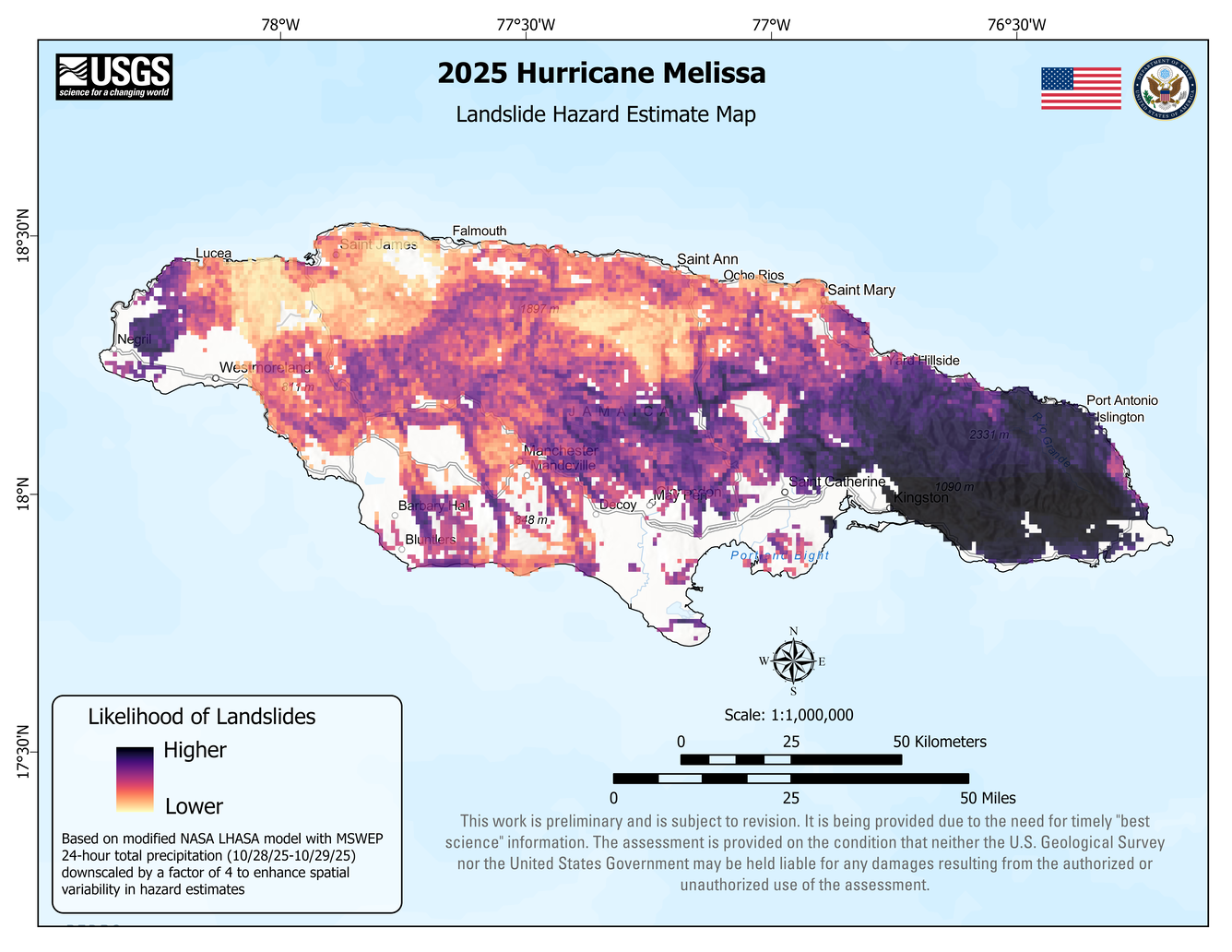
Map of landslide hazard in Jamaica following 2025 Hurricane Melissa
Detailed Description
Map showing areas in Jamaica where landslides were estimated to be most likely to occur (dark purple areas) and less likely to occur (tan colors or white areas) during 2025 Hurricane Melissa. This map was used to estimate where landslides might have occurred immediately following the storm until more information about what happened on the ground was available. It is not a map of landslide occurrences. The map was made using a modified version of NASA’s LHASA model, which combines information on slope steepness, past landslides, soil conditions, and rainfall to estimate where landslides might happen.
Sources/Usage
Public Domain.
Related
2025 Hurricane Melissa Landslide Hazards
Hurricane Melissa, a category 5 storm, made landfall on October 28, 2025, near the border of Westmoreland and St. Elizabeth Parishes, southwestern Jamaica. The storm brought heavy rainfall, strong winds, and flooding to much of the Caribbean. In Jamaica, intense rainfall on steep mountainous terrain raised concern about potential landslides. This landslide event page serves as an event summary to...