
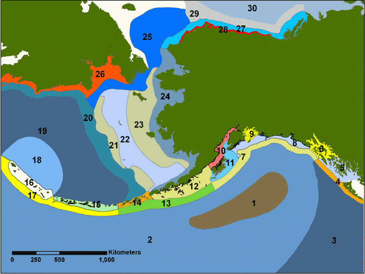
Map of marine ecoregions around Alaska
By Alaska Science Center
January 2007 (approx.)
Detailed Description
The Marine Ecoregions layer is based upon the work of Piatt and Springer (2007). This data layer was constructed to allow researchers access to a standard map of meso-scale marine eco-regions for the waters surrounding Alaska. These eco-regions were delineated using information available on the distribution of marine organisms such as plankton, fish, seabirds and marine mammals and with respect to physical characteristics such as bathymetry, currents, and sea surface temperature. The data layer is an ESRI Shapefile with a separate metadata file in html format. The polygon shapefile is in the Alaska Albers Conical Equil Area projection.
Sources/Usage
Public Domain.