
Map of New England streamflow
By New England Water Science Center
2020 (approx.)
Detailed Description
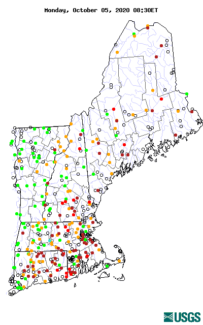
This is a static map, however the map on the USGS WaterWatch page shows the current real-time streamflow conditions for New England stations.
The colors represent the real-time streamflow compared to percentiles of historical daily streamflow for the day of the year. Only streamgages with at least 30 years of record are used.
The data used are provisional and have not been reviewed or edited. They may be subject to significant change.
Sources/Usage
Public Domain.