
Map of Rodgers Creek Fault

Detailed Description
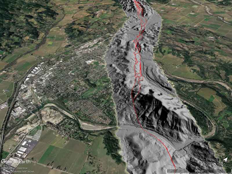
A Google Earth™ image showing the principal zone of faulting (in red) near the town of Healdsburg, overlain on a hillshade image from a LiDAR survey along the fault.
Sources/Usage
Public Domain.
Related

A New Map of Rodgers Creek Fault in Sonoma County, California
Release Date: JULY 16, 2018 A new more detailed and higher resolution map of the Rodgers Creek Fault in Sonoma County, California, has been produced using aerial photography and hillshade imagery derived from LiDAR data.
Related
A New Map of Rodgers Creek Fault in Sonoma County, California
Release Date: JULY 16, 2018 A new more detailed and higher resolution map of the Rodgers Creek Fault in Sonoma County, California, has been produced using aerial photography and hillshade imagery derived from LiDAR data.