
Map of SF Bay showing bathymetric change.jpg
Detailed Description
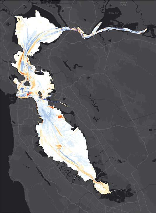
Map showing rates of bathymetric change in San Francisco Bay from the 1980s to 2010s, from the study Sediment Deposition, Erosion, and Bathymetric Change in San Francisco, California, 1971-1990 and 1999-2020
Sources/Usage
Public Domain.