
Map & Velocity Mapping Tool- stream velocity
By Pennsylvania Water Science Center
July 2021 (approx.)
Detailed Description
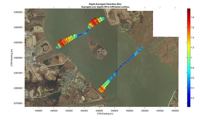
Map & Velocity Mapping Tool (VMT) plot of provisional stream velocity measurements both upstream & downstream of Pea Patch Island near the C&D Canal on the Delaware River. These measurements were taken sequentially as the tide was turning from flood to ebb. The area about Pea Patch Island & C&D Canal has been defined as a crucial area to fill data gaps for multiple models being developed by DRBC & USGS.
Sources/Usage
Public Domain.