
Maps of Denali with proposed reroutes of Park Road
By Geosciences and Environmental Change Science Center
April 2020 (approx.)

Detailed Description
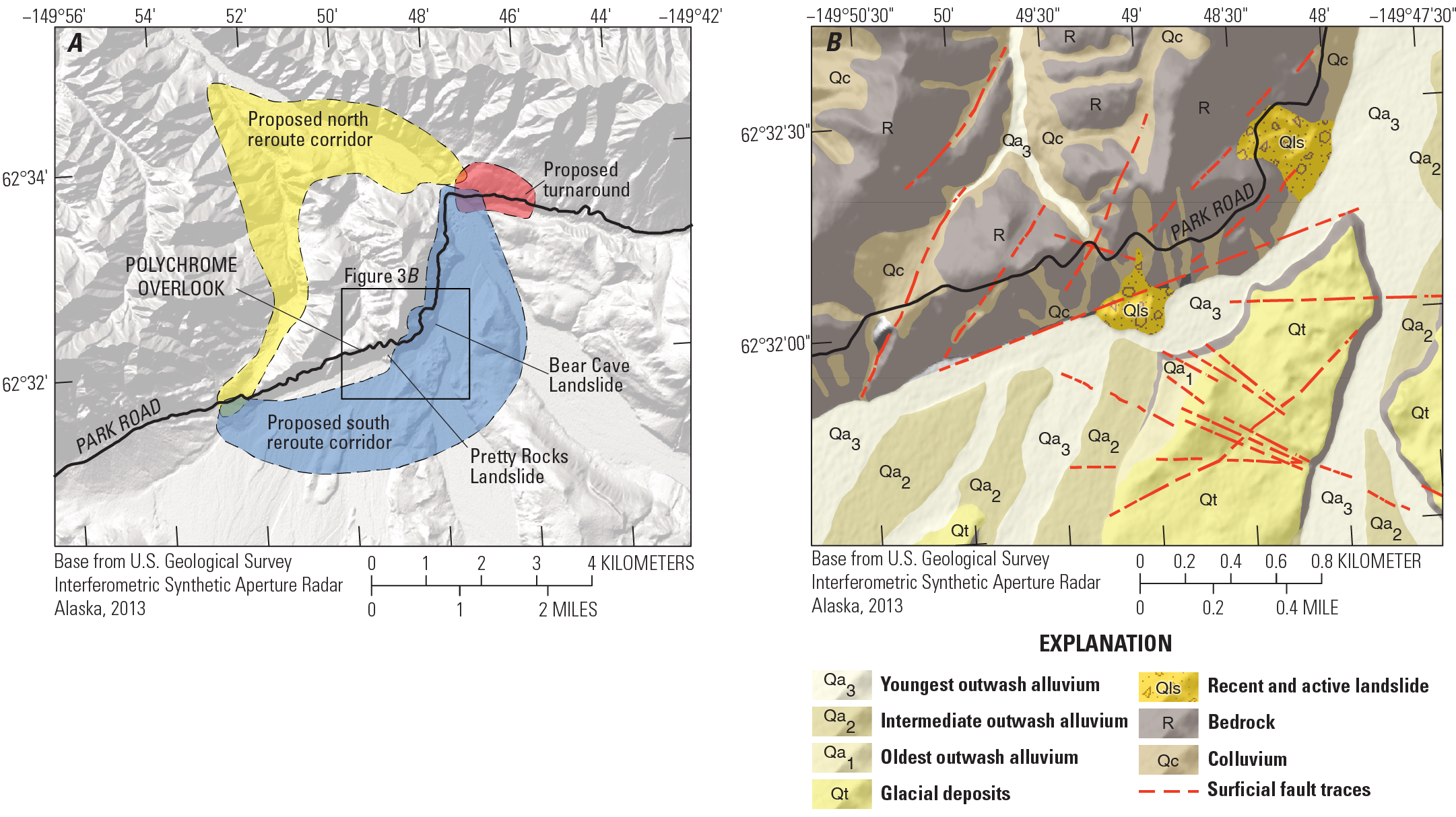
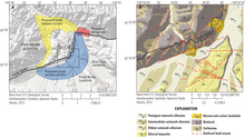
A, Polychrome Overlook area with proposed road reroutes around landslide hazards. B, U.S. Geological Survey geologic map of surficial deposits along Polychrome Overlook with known large landslides (Qls) shown on current Park Road compared to alluvial and glacial deposits with lower landslide hazard on the southern reroute option.
Sources/Usage
Public Domain.
Assessing Geohazards to the Denali National Park Road with Geologic Mapping
From USGS Fact Sheet 2020-3016
Related

Denali National Park Geohazards Geologic Mapping
Denali National Park (DENA) is a major draw for tourism and recreation and a major economic engine for central Alaska. However, the geologic forces that created the steep landscape of DENA also make it prone to geologic hazards (geohazards) like landslides, debris flows, and earthquakes. DENA has only one major road, called the ‘Park Road’, that serves nearly all of its infrastructure. Since 2017...
Related
Denali National Park Geohazards Geologic Mapping
Denali National Park (DENA) is a major draw for tourism and recreation and a major economic engine for central Alaska. However, the geologic forces that created the steep landscape of DENA also make it prone to geologic hazards (geohazards) like landslides, debris flows, and earthquakes. DENA has only one major road, called the ‘Park Road’, that serves nearly all of its infrastructure. Since 2017...