
March 11, 2011 M9.0 Tohoku, Japan Earthquake Early Warning Times
Detailed Description
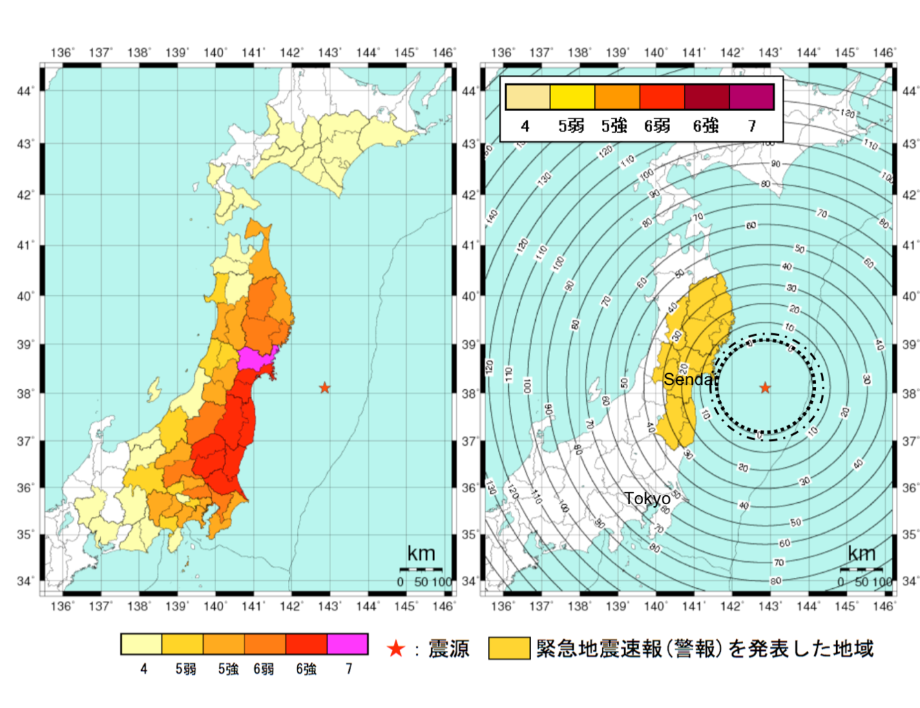
Two maps of the March 11, 2011 M9.0 Tohoku-oki, Japan earthquake region with the offshore earthquake epicenter shown as a red star. The map on the left shows the observed shaking intensities using the JMA (Japan Meteorological Agency) Intensity Scale. The map on the right shows the initial EEW warning times as concentric circles. The innermost dotted circle doesn’t include the 2-second communication latency, but the next dash-dotted circle does include the latency. Residents on the east coast had up to 15 seconds of warning, however residents in Tokyo had no warning, where there was intensity 5 shaking. (from Wald, 2020, see reference below)
Sources/Usage
Public Domain.
Practical limitations of earthquake early warning
Wald, D. J. (2020). Practical limitations of earthquake early warning. Earthquake Spectra.
Related

The Blind Zone of Earthquake Early Warning
Related