
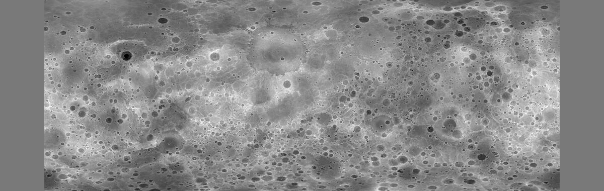
Mercury MESSENGER Global DEM 665m (64ppd) v2 Oct. 2016
Detailed Description
The MErcury Surface, Space ENvironment, GEochemistry, and Ranging (MESSENGER) spacecraft completed its mission to acquire a rich variety of orbital data from the planet Mercury. Using the Integrated Software for Imagers and Spectrometers (ISIS3) and observations from Mercury Dual Imaging System (MDIS) narrow-angle camera (NAC) and multispectral wide-angle camera (WAC), we derived a global digital elevation model (DEM) of Mercury.
We created the global DEM of Mercury from a least-squares bundle adjustment (jigsaw in ISIS3 [Becker 2016]) of common features, measured as tie point coordinates in overlapping NAC and WAC-G filter images. The MDIS image inventory contains over 176,000 NAC and WAC-G observations with a very large variety of disparate geometric and illumination characteristics, and we encountered limitations to existing conventional control techniques in ISIS3 that required development of new software and techniques. Our main objectives were to 1) significantly improve image tie point matching accuracy while increasing control point density, and 2) greatly reduce the resources, both human and computer, required to control large image data sets. The new approach utilizes unsupervised image-to-image feature-based matching and control techniques that are well suited for scaling and distribution across compute cluster environments (Becker 2016).
This is version 2 of the product derived using a 1-sigma filter applied to the point cloud when processing each output pixel. The original version (1) did not have this filter applied.
Sources/Usage
Public Domain.