
Mesquite Flat
Detailed Description
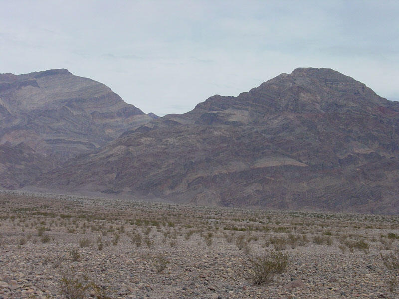
This view from Highway 267 (between Beatty Junction and Grapevine) is looking east up the alluvial fan of Titanothere Canyon. Mt. Thimble (6,381 feet) is on the left and Corkscrew Peak (5,804 feet) is on the right. The layers exposed in the mountainsides consist of marine sedimentary rock formations of Late Proterozoic and Cambrian age (Hunt and Mabey, 1966; Hunt, 1975). These rocks, mostly dolomite, limestone, and sandstone, formed from sediments deposited in a warm, shallow seas along what was a shelf-margin platform offshore of the coast of the ancestral western North America.
Sources/Usage
Public Domain.