
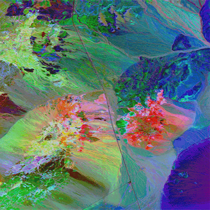
Mineral map derived from AVIRIS data obtained over Cuprite, Nevada, in
Detailed Description
Imaging spectroscopy is a relatively new field whose instrumentation and analysis methods have grown in sophistication over the last decade. We have studied the signal-to-noise of the NASA/JPL AVIRIS instrument from 1990 to 1995 along with the improvements in our own analysis methods using the Cuprite, Nevada data available each year. The advantage of becoming familiar with a single test site, by studying both the data obtained, as well as conducting field trips to verify results, helps to understand the complexity of the surficial mineralogy at the site. The desert environment of Cuprite provides a relatively stable environment from year to year, which is important for assessing progress in algorithms and sensors.
Sources/Usage
Public Domain.
Imaging Spectroscopy Material Maps: Cuprite Introduction
Derived From: Clark and Swayze, Summaries of the 6th Annual JPL Airborne Earth Science Workshop March 4-8, 1996