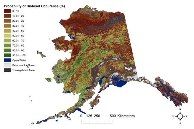
Modeled probabilistic map of histosol distributions for Alaska.

Detailed Description
Modeled probabilistic map of histosol (organic layer thickness > 40 cm) distributions for Alaska. *Unvegetated areas are predominately barren land and developed areas.
Sources/Usage
Public Domain.

