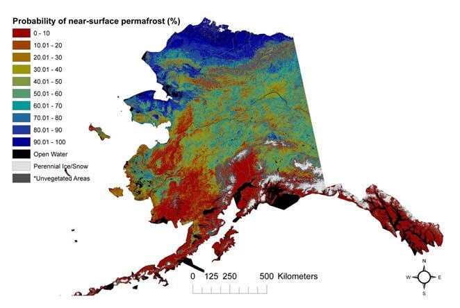
Modeled probabilistic map of near-surface permafrost within Alaska

Detailed Description
Modeled probabilistic map of near-surface (within 1 m) permafrost distributions of Alaska. *Unvegetated areas are predominately barren land and developed areas.
Sources/Usage
Public Domain.

