
Monterey Canyon and Vicinity
By Pacific Coastal and Marine Science Center
2016 (approx.)

Detailed Description
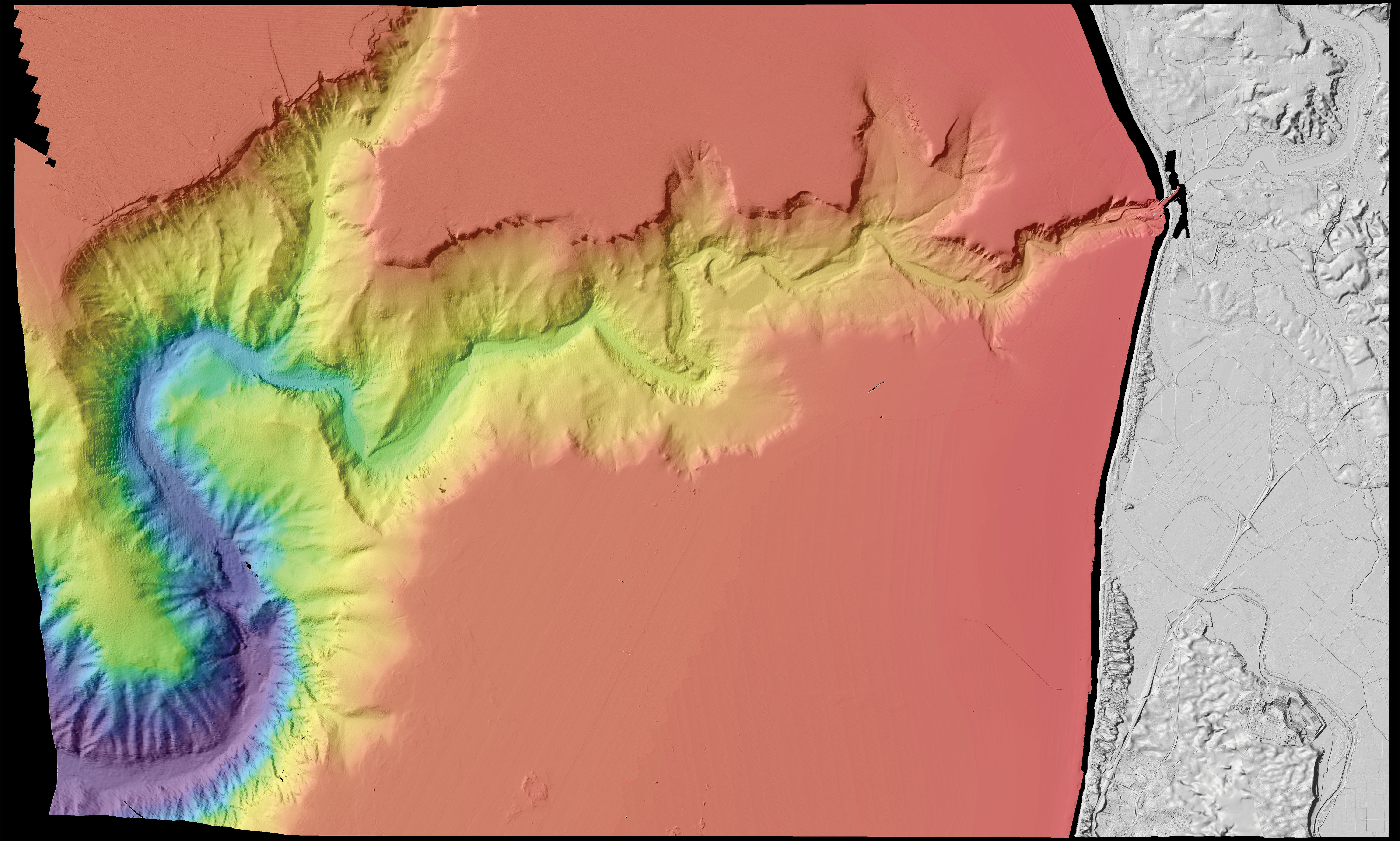
Map view. Colored shaded-relief bathymetry map of Monterey Canyon and Vicinity map area, generated from multibeam-echosounder and bathymetric-sidescan data. Colors show depth: reds and oranges indicate shallower areas; purples, deeper areas. Illumination azimuth is 300°, from 45° above horizon.
Sources/Usage
Public Domain.
No copyright
Related

California Seafloor and Coastal Mapping Program
A Foundation for Characterizing Hazards, Monitoring Change, and Managing Resources
Related
California Seafloor and Coastal Mapping Program
A Foundation for Characterizing Hazards, Monitoring Change, and Managing Resources