
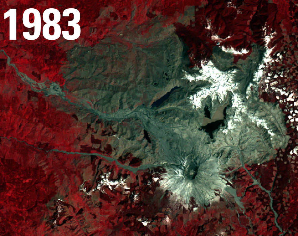
Mount St. Helens, Washington, USA, 1983
Detailed Description
Mount St. Helens is an active stratovolcano in southwest Washington State. After months of rumbling, May 18, 1980 the volcano erupted and sent millions of tons of rock and debris skyward. The eruption was preceded by a series of earthquakes and steam-venting episodes, and an earthquake on May 18 caused the entire weakened north face to slide away, creating the largest landslide ever recorded. This allowed the high-pressure gas and steam to suddenly explode northwards. The eruption blocked out the sun in parts of central and eastern Washington and sent massive waves of instantly-melted snow and millions blasted trees down river valleys.
This Landsat 4 image clearly shows the changed landscape 3 years after the event.
Prior to 1980, Mt. St. Helens had the shape of a conical volcano and towered about a mile above its base. During the 1980 eruption, the upper 400 meters (1,300 ft) of the summit was removed by a huge debris avalanche, leaving a 2 x 3.5 km horseshoe-shaped crater now partially filled by a lava dome and a glacier. When measured on July 1, 1980, the mountain's height had been reduced by about 1,300 feet - from 9,677 feet to 8,364 feet.
Visit the USGS Earthshots page to see more images that show the landscape change over time.
Sources/Usage
Public Domain.