
Mountain Pass geophysical maps
By Geology, Minerals, Energy, and Geophysics Science Center
2021 (approx.)

Detailed Description
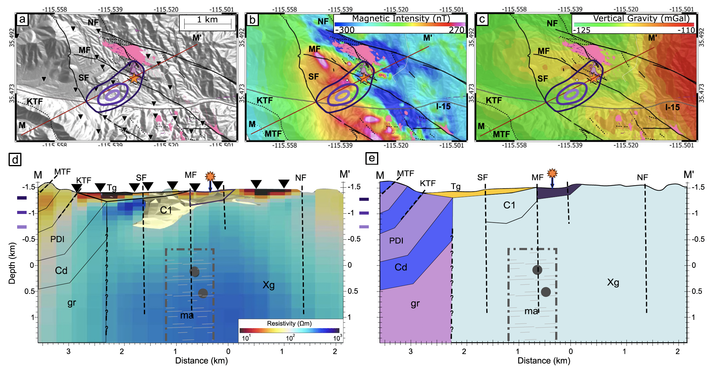
Geophysical maps of the Mountain Pass intrusive system. A. LiDAR map, with depth of electrical resistivity model contoured in purple lines (lighter is deeper). B. Magnetic intensity map. C. Vertical gravity map. D. Cross section of electrical resistivity model along M-M'. E. Potential field model of the geology along M-M'. From Peacock et al. (2021).
Sources/Usage
Public Domain.
Related

Multidisciplinary Investigations of REE Mineralization at Mountain Pass and in the Southeast Mojave Desert, California
The rare earth elements (REEs) are a group of metals with unique physical and chemical properties that are critical to a variety of technological applications. For example, neodymium (Nd) is a REE used to manufacture high strength, lightweight magnets that power electric motors at all scales, from cell phones to airplanes. Reliance on REE imports puts the U.S. at high risk for supply disruption...
Related
Multidisciplinary Investigations of REE Mineralization at Mountain Pass and in the Southeast Mojave Desert, California
The rare earth elements (REEs) are a group of metals with unique physical and chemical properties that are critical to a variety of technological applications. For example, neodymium (Nd) is a REE used to manufacture high strength, lightweight magnets that power electric motors at all scales, from cell phones to airplanes. Reliance on REE imports puts the U.S. at high risk for supply disruption...