
Mt. Rainier Geophysical Magnetic Image 1996 Flight
By Geology, Geophysics, and Geochemistry Science Center
2007 (approx.)
Detailed Description
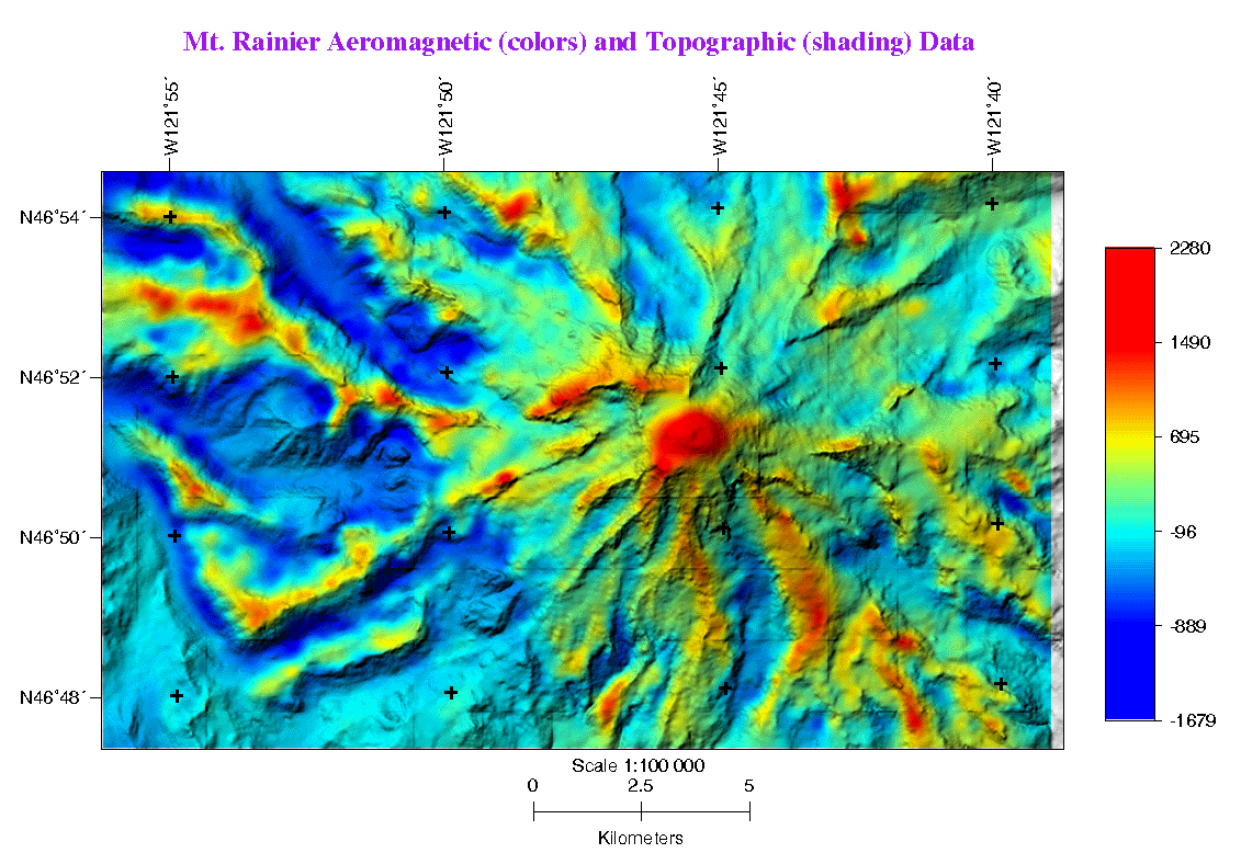
Resulting aeromagnetic map of Mt. Rainier from 1996 flight. The image shows reduced-to-the-pole magnetic data represented in grid form, draped over topography of Mt. Rainier. From Rystrom and others, 2000, https://doi.org/10.3133/ofr200027.
Sources/Usage
Public Domain.
High Resolution, Low Altitude Aeromagnetic and Electromagnetic Survey of Mt Rainier
V.L. Rystrom, Carol A. Finn, and Maryla Deszcz-Pan, 2000, High Resolution, Low Altitude Aeromagnetic and Electromagnetic Survey of Mt Rainier: U.S. Geological Survey Open-File Report 2000-27, online only, https://doi.org/10.3133/ofr200027.