
Mud Creek 2017 May 27-June 13 Erosion View 1
Detailed Description
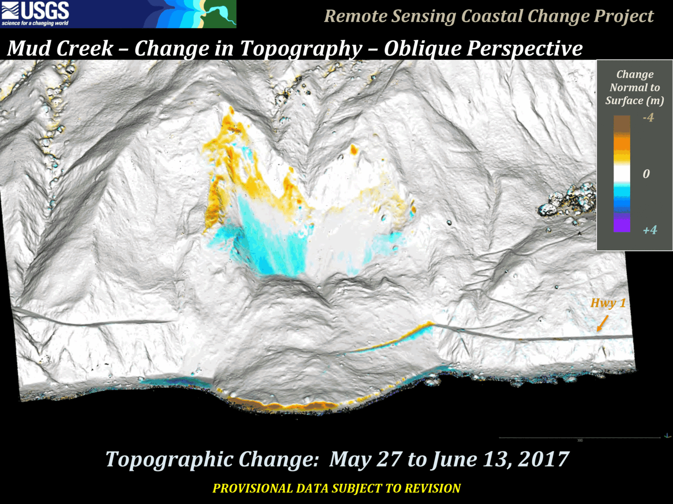
In 2017, the massive Mud Creek landslide buried a quarter-mile of the famous coastal route, California’s Highway 1, with rocks and dirt more than 65 feet deep. USGS monitors erosion along the landslide-prone cliffs of Big Sur, collecting aerial photos frequently throughout the year. By analyzing overlapping photos, they made precise maps of the slopes and calculated volumes of material lost or gained over time. The last slide in this animation shows the differences between the May 27 and June 13 photos, calculating the volume of land lost or gained.
Sources/Usage
Public Domain.
Related

The Mud Creek Landslide May 20 2017
On May 20, 2017, the steep slopes at Mud Creek on California’s Big Sur coast, about 140 miles south of San Francisco, suffered a catastrophic collapse. USGS scientists from the Pacific Coastal and Marine Science Center and the Geology, Minerals, Energy, and Geophysics Science Center continue to monitor this section of the coastline, in collaboration with the California Department of Transportation...
Related
The Mud Creek Landslide May 20 2017
On May 20, 2017, the steep slopes at Mud Creek on California’s Big Sur coast, about 140 miles south of San Francisco, suffered a catastrophic collapse. USGS scientists from the Pacific Coastal and Marine Science Center and the Geology, Minerals, Energy, and Geophysics Science Center continue to monitor this section of the coastline, in collaboration with the California Department of Transportation...