
Neospatial Florida Everglades National Park QL1 Lidar
Detailed Description
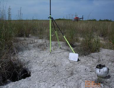
High-resolution lidar to support critical environmental management objectives in response to sea level rise, predicitive hydrologic modeling. The data will also support a study to understand the unique Everglades marl prairie habitat for the Cape Sable Seaside Sparrow, an endangered non-migraotory song bird residing solely in the Everlgades. Lidar missions were flown April 19, 2017 through May 31, 2017.
Sources/Usage
Public Domain.