
Northern Atlantic Coastal Plain aquifer system map

Detailed Description
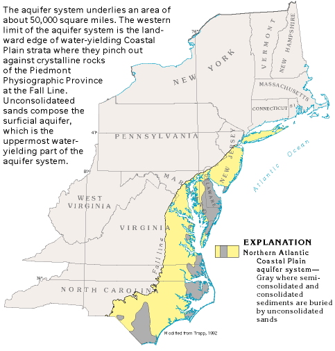
The aquifer system underlies an area of about 50,000 square miles. The western limit of the aquifer system is the landward edge of water-yielding Coastal Plain strata where they pinch out against crystalline rocks of the Piedmont Physiographic Province at the Fall Line. Unconsolidated sands compose the surficial aquifer, which is the uppermost water-yielding part of the aquifer system.
Sources/Usage
Public Domain.
Related

List of semiconsolidated sand and gravel aquifers
Semiconsolidated aquifers of the United States, which consist of semiconsolidated sand interbedded with silt, clay, and minor carbonate rocks.
Related
List of semiconsolidated sand and gravel aquifers
Semiconsolidated aquifers of the United States, which consist of semiconsolidated sand interbedded with silt, clay, and minor carbonate rocks.