
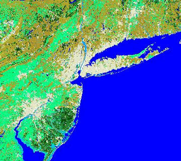
The NYC Region - map of landuse/land cover of the New York City region
Detailed Description
A map of landuse/land cover of the New York City region. Light colored areas ore urban and suburban areas. Light green represents agricultural lands. Brown represents deciduous forests (undeveloped watershed) and pine forests. Dark green areas are lands covered with pine forests. Light blue represents wetlands (courtesy of Karen Mulcahy).
Sources/Usage
Public Domain.