
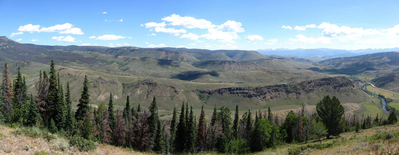
Panorama view of Mt. Bross
By Geosciences and Environmental Change Science Center
August 07 (approx.)
Detailed Description
Mt. Bross: Photomosaic view over the southern Colorado Headwaters Basin (CHB) from the west flank of the Breccia Spoon syncline. Brownish, rugged ridge in the middle ground (just above the foreground trees) is the Windy Gap Volcanic Member deposited on the eroded Pierre Shale. Stair-step topography in the distance reflects sedimentary architecture of the Middle Park Formation marked by interbedded fluvial sandstone-siltstone sequences capped by persistent conglomerate zones. Colorado River at lower right flows toward the viewpoint at Mount Bross, just north of Hot Sulphur Springs.