
Plot of earthquakes at Mount Hood since 2010
Detailed Description
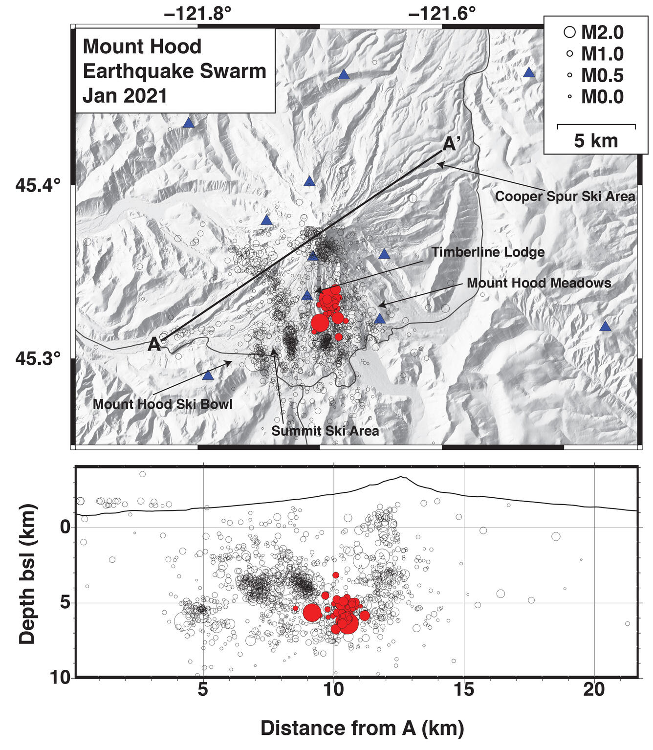
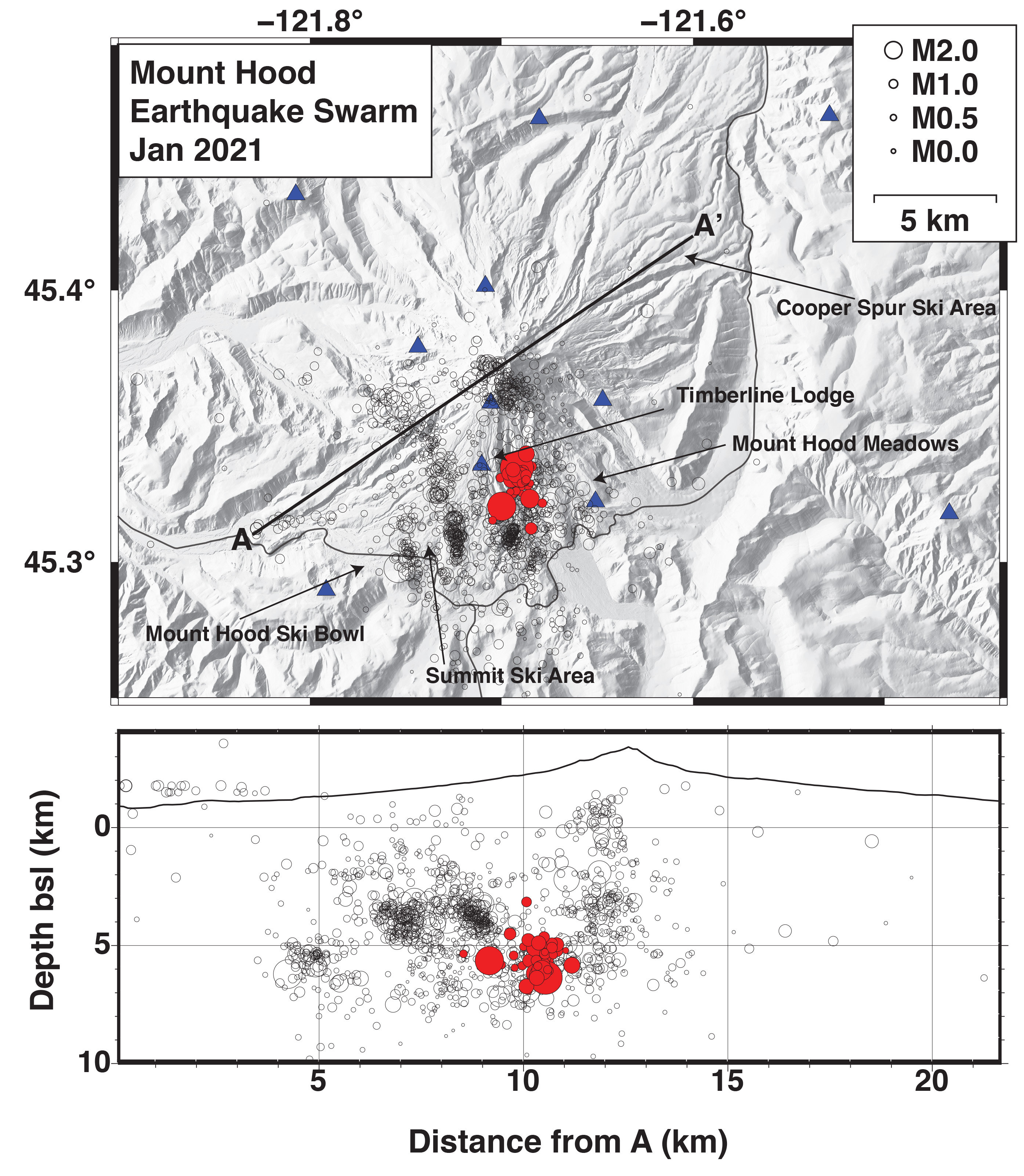
Top: Map View of earthquakes at Mount Hood since 2010 (black circles) and the current swarm (red circles), both sized by magnitude. Blue triangles are current seismic stations. Dark lines are highways around the volcano. Bottom: Cross section from line between A and A' above. Dark line is outline of volcano. Earthquakes marked as above.
Sources/Usage
Public Domain.