
Pre-Storm and Post-Storm 3D Lidar Topography - Chandeleur Islands
By St. Petersburg Coastal and Marine Science Center
2012 (approx.)
Detailed Description
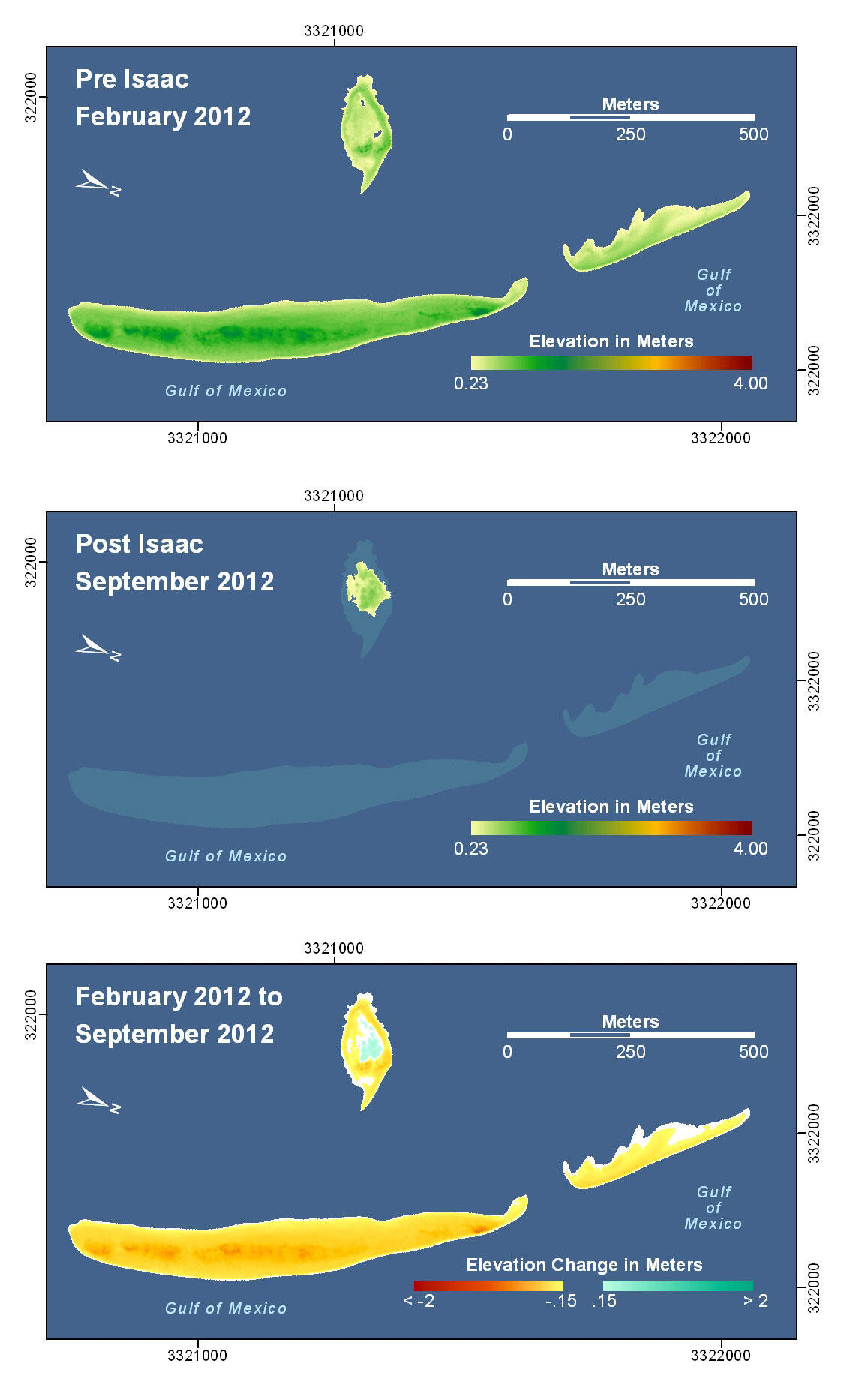
The remnants of the sand-berm constructed in front of the Chandeleur Islands is visible in pre-storm elevation map and were completely eroded by Hurricane Isaac. (The footprint of the pre-storm berm remnants are depicted with light shading in the post-storm elevation map.) The remnant island behind the berm experienced erosion along the outer edge and some deposition in the low region at the center.
Sources/Usage
Public Domain.