
Quaternary geology map of Santa Cruz Island
By Geology, Minerals, Energy, and Geophysics Science Center
2018 (approx.)
Detailed Description
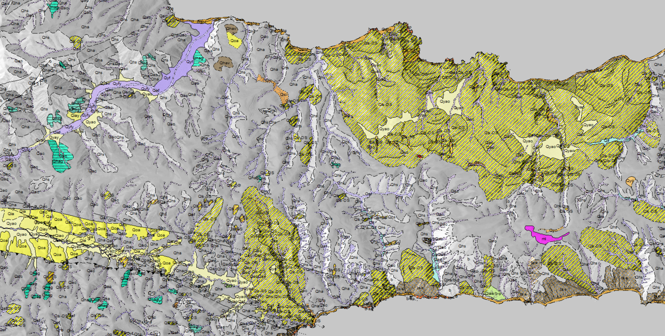
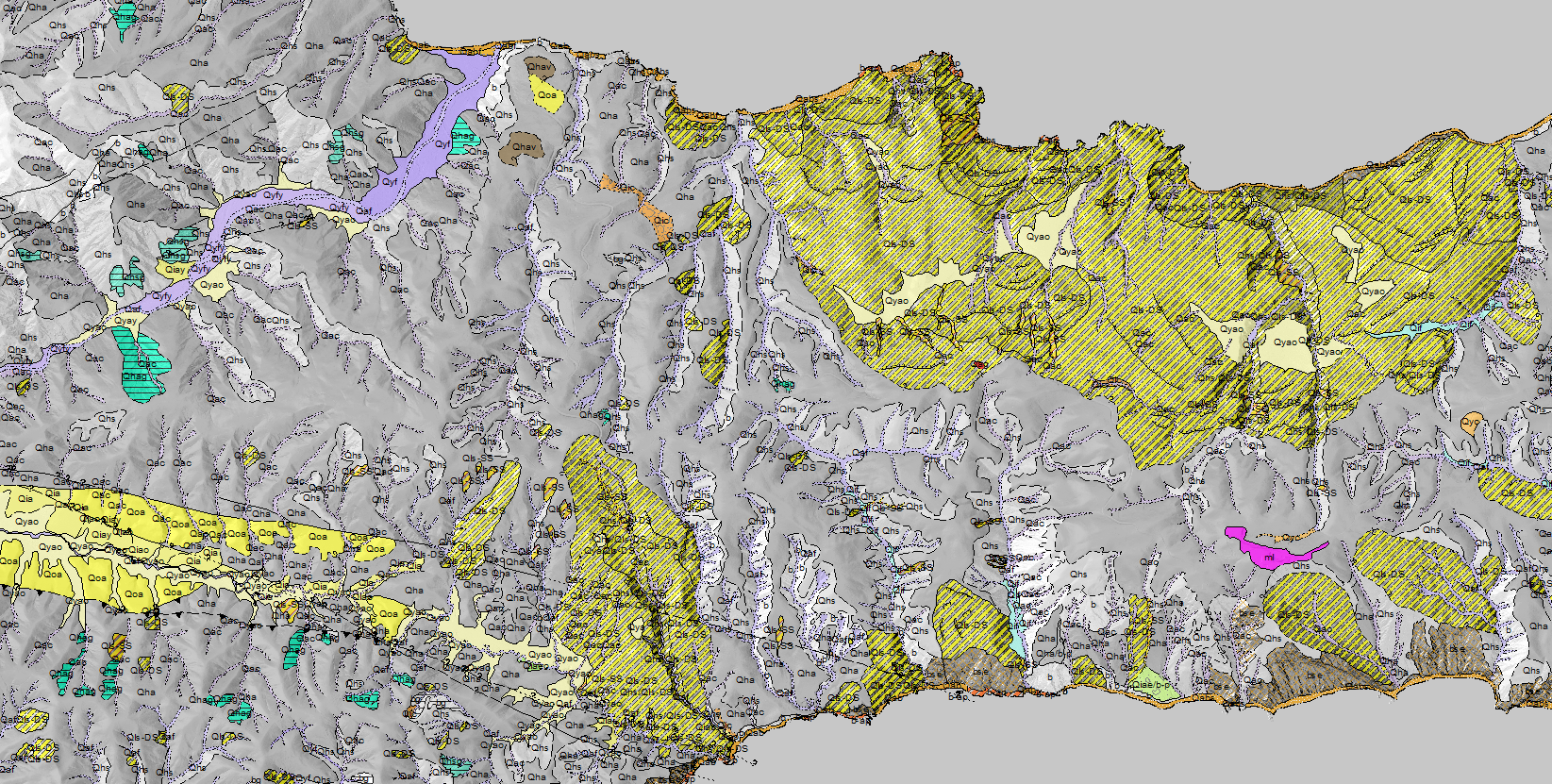
Detailed Quaternary surficial geology map of Santa Cruz Island within Channel Islands National Park. Map units depict east-west striking Santa Cruz Island Fault with older alluvium (Qoa) in solid yellow. Young fluvial deposits (Qyf) near Prisoners Harbor depicted in magenta. Large deep-seated landslides (Qls-DS) in yellow and gray diagonal pattern. Geology shown as transparency over liar-derived hillshade.
Sources/Usage
Courtesy: Kevin Schmidt