
Queen Charlotte-Fairweather fault
By Pacific Coastal and Marine Science Center
2015 (approx.)

Detailed Description
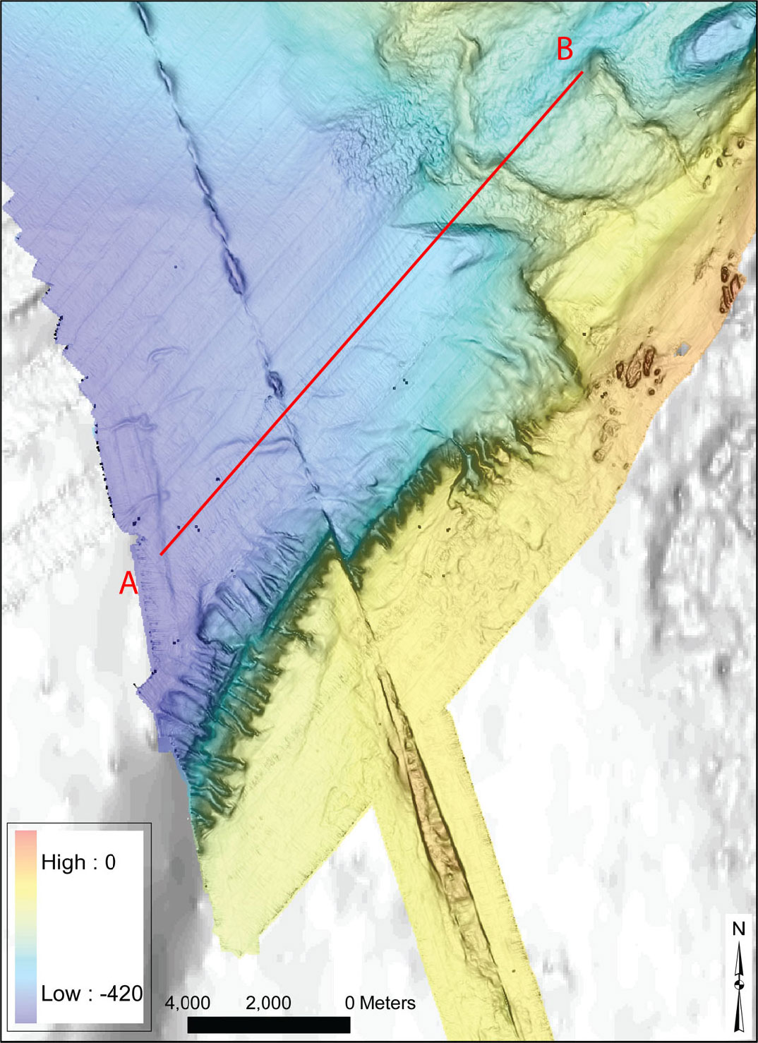
Multibeam bathymetry data (rainbow colors) acquired on R/V Solstice near Cross Sound and Glacier Bay National Park, southeastern Alaska. The Queen Charlotte-Fairweather fault runs through the middle of the image from upper left to lower-middle right. The map shows en echelon basins along the fault and right-lateral offset of the south wall of the Yakobi Sea Valley. Line A–B is the location of a multichannel seismic-reflection profile.
Sources/Usage
Public Domain.
Related

Coastal and Marine Geohazards of the U.S. West Coast and Alaska
Coastal and marine geohazards are sudden and extreme events beneath the ocean that threaten coastal populations. These underwater hazards include earthquakes, volcanic eruptions, landslides, and tsunamis. The tectonically active west coast of the Americas is prone to such hazards, as it lies along the boundaries of major tectonic plates that make up the Earth's crust—the North American, Caribbean...

Earthquake Hazards in Southeastern Alaska
Over the last 100 years, the Queen Charlotte-Fairweather fault system has produced large-magnitude earthquakes affecting both Canada and the U.S. To fill in missing details about its offshore location and structure, USGS uses sophisticated techniques to truly understand the fault’s hazard potential.
Related
Coastal and Marine Geohazards of the U.S. West Coast and Alaska
Coastal and marine geohazards are sudden and extreme events beneath the ocean that threaten coastal populations. These underwater hazards include earthquakes, volcanic eruptions, landslides, and tsunamis. The tectonically active west coast of the Americas is prone to such hazards, as it lies along the boundaries of major tectonic plates that make up the Earth's crust—the North American, Caribbean...
Earthquake Hazards in Southeastern Alaska
Over the last 100 years, the Queen Charlotte-Fairweather fault system has produced large-magnitude earthquakes affecting both Canada and the U.S. To fill in missing details about its offshore location and structure, USGS uses sophisticated techniques to truly understand the fault’s hazard potential.