
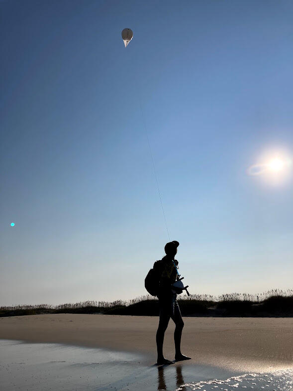
Repeat surveys of the beach are accomplished with a Helikite
Detailed Description
An alternative to uncrewed aerial systems (UAS; commonly known as 'drones'), USGS scientists use helikites equipped with cameras to collect imagery of the coastline. The pictures collected by these helium-kite-balloons are used to create a digital elevation model with structure- from-motion techniques. Here, USGS scientist Jin-Si Over tows a helikite down a beach at Pea Island National Wildlife Refuge as part of DUNEX.
Sources/Usage
Public Domain.