
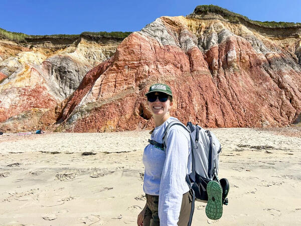
Jennifer Cramer, a geographer and drone pilot at the Woods Hole Coastal and Marine Science Center, walks in front of a colorful section of the Aquinnah Cliffs. The Aerial Imaging and Mapping team was ground truthing multispectral and lidar UAS data collected of the exposed cliffs and beach.
Jin-Si R Over
Jin-Si Over is a geographer with the Woods Hole Coastal and Marine Science Center. A drone pilot and structure-from-motion specialist, she supports the Remote Sensing Coastal Change group and Aerial Imaging and Mapping group with GIS and surveying experience.
I have a background in micro-paleontology and working in coastal paleo-environments but gained more modern coastal mapping experience through the NOAA Hollings Scholars program in Hawaii - the beach stole my heart.
Now, as a geographer, my job enables me support coastal data collection, management, and scientific dissemination surrounding coastal responses to storms and hurricanes. This centers around GIS data, aerial imagery and stationary imagery, and processing imagery using structure-from-motion. I focus on datasets on Cape Cod National Seashore and on the Outer Banks. I am also a DOI and FAA licensed drone-pilot and assist in operations at beaches and marshes.
Additionally, I am active in science communication and mentoring efforts on the local scale and am passionate about fostering an inclusive and diverse scientific community.
Science and Products

Remote Sensing Coastal Change
We use remote-sensing technologies—such as aerial photography, satellite imagery, structure-from-motion (SfM) photogrammetry, and lidar (laser-based surveying)—to measure coastal change along U.S. shorelines.

DUNEX Aerial Imagery of the Outer Banks
The During Nearshore Event Experiment (DUNEX) project is a large collaborative scientific study focusing on understanding the consequences of coastal storms on the morphology of coastal ecosystems. By flying large sections of the coast and collecting still images using structure from motion (SfM) techniques, we hope to contribute high resolution (20cm) elevation maps for time series comparisons...

DUNEX Pea Island Experiment
The DUring Nearshore Event eXperiment (DUNEX) is an aggregation of multiple scientific organizations collaborating to increase understanding of nearshore processes. The U.S. Geological Survey (USGS) has chosen Pea Island National Wildlife Refuge as a study location to investigate and characterize the magnitude and timing of changes to coastal morphology (i.e., dunes, shorelines), bathymetry, and...

Aerial Imaging and Mapping
The Aerial Imaging and Mapping group (AIM), at the U.S. Geological Survey Woods (USGS) Hole Coastal and Marine Science Center provides UAS services to scientists to advance the science mission of the Coastal and Marine Geology Program. Scientists at the Woods Hole Coastal and Marine Science Center have been using UASs to acquire imagery of coastal and wetland environments, which is then used to...
Filter Total Items: 22
USGS geographer and drone pilot at work
Jennifer Cramer, a geographer and drone pilot at the Woods Hole Coastal and Marine Science Center, walks in front of a colorful section of the Aquinnah Cliffs. The Aerial Imaging and Mapping team was ground truthing multispectral and lidar UAS data collected of the exposed cliffs and beach.

UAS Pilot Jennifer Cramer attaches a YellowScan Mapper+ lidar sensor to the underside of a DJI M600 in preparation to map the beach and marsh
UAS Pilot Jennifer Cramer attaches a YellowScan Mapper+ lidar sensor to the underside of a DJI M600 in preparation to map the beach and marshUAS Pilot Jennifer Cramer attaches a YellowScan Mapper+ lidar sensor to the underside of a DJI M600 in preparation to map the beach and marsh.
Town Neck Beach, Sandwich, Massachusetts
Fall 2024 Photo Contest Winner: Jin-Si Over, People category
")
The USGS Northeast Region: Delivering Science for Better Decisions (AD)
The USGS Northeast Region: Delivering Science for Better Decisions (AD)This video is an introduction of the USGS Northeast Region's science efforts to support society's evolving needs through its engaged and skilled workforce.
The USGS Northeast Region: Delivering Science for Better Decisions (AD)
The USGS Northeast Region: Delivering Science for Better Decisions (AD)This video is an introduction of the USGS Northeast Region's science efforts to support society's evolving needs through its engaged and skilled workforce.

The USGS Northeast Region: Delivering Science for Better Decisions
The USGS Northeast Region: Delivering Science for Better DecisionsThis video is an introduction of the USGS Northeast Region's science efforts to support society's evolving needs through its engaged and skilled workforce.
The USGS Northeast Region: Delivering Science for Better Decisions
The USGS Northeast Region: Delivering Science for Better DecisionsThis video is an introduction of the USGS Northeast Region's science efforts to support society's evolving needs through its engaged and skilled workforce.

Hurricane Lee sensor retrieval
Marie Bartlett (USGS) removes fence post at Marconi Beach in Wellfleet, MA while recovering pressure sensor. Pressure sensors were attached to fence posts and hammered into the sand to measure total water levels of Hurricane Lee. Photo by Jin-Si Over, USGS.
Marie Bartlett (USGS) removes fence post at Marconi Beach in Wellfleet, MA while recovering pressure sensor. Pressure sensors were attached to fence posts and hammered into the sand to measure total water levels of Hurricane Lee. Photo by Jin-Si Over, USGS.

Hurricane Lee drone imagery
USGS scientists Jen Cramer and Jin-Si Over pilot a drone at Nauset Light Beach in Nauset, MA. Drone imagery will be used to monitor coastal change before and after Hurricane Lee. Photo by Mira Anderberg, USGS.
USGS scientists Jen Cramer and Jin-Si Over pilot a drone at Nauset Light Beach in Nauset, MA. Drone imagery will be used to monitor coastal change before and after Hurricane Lee. Photo by Mira Anderberg, USGS.

UAS demonstration in Woods Hole, Massachusetts
A UAS demonstration in Woods Hole, Massachusetts with WH-Coastal and Marine Science Center personnel and NE Region administration.
Summer 2023 NER Photo Contest Winner: Jin-Si Over, People category
A UAS demonstration in Woods Hole, Massachusetts with WH-Coastal and Marine Science Center personnel and NE Region administration.
Summer 2023 NER Photo Contest Winner: Jin-Si Over, People category

Chris Sherwood drives a remote controlled surface vehicle named the Yellow Cat
Chris Sherwood drives a remote controlled surface vehicle named the Yellow CatChris Sherwood (USGS) drives a remote controlled surface vehicle named the Yellow Cat - built by Peter Traykovski (WHOI) - that is mapping the bathymetry of a pond on North Core Banks with a small echo-sounder in Cape Lookout National Seashore, North Carolina.
Fall 2022 Photo Contest: Jin-Si Over, Honorable Mention category

USGS field crew walk through spike rush as they complete vegetation surveys
USGS field crew walk through spike rush as they complete vegetation surveysUSGS field crew (left to right) Sara Zeigler, Alexandra Evans, and Jennifer Cramer walk through spike rush as they complete vegetation surveys with GPS equipment and a quadrat in North Core Banks, Cape Lookout National Seashore, NC.
Fall 2022 Photo Contest Winner: Jin-Si Over, Where We Work category

Aerial Imaging and Mapping Group (AIMG) preparing for a day of field work
Aerial Imaging and Mapping Group (AIMG) preparing for a day of field workThe Aerial Imaging and Mapping Group (AIMG) preparing for a day of field work at Assateague Island National Seashore.
(Left to right then front: Sandra Brosnahan, Alexandra Evans, Jennifer Cramer, Seth Ackerman, Erika Lentz, Jin-Si Over)
Fall 2022 Photo Contest Winner: Jin-Si Over, People category

Robert (Bo) Bales works on a Aquadopp for deployment
Robert (Bo) Bales works on a Aquadopp for deploymentPhoto Contest Winner | September 2021 | People
Robert (Bo) Bales works on a Aquadopp for deployment
Robert (Bo) Bales works on a Aquadopp for deployment
Robert (Bo) Bales works on a Aquadopp for deploymentPhoto Contest Winner | September 2021 | People
Robert (Bo) Bales works on a Aquadopp for deployment

USGS personnel and contracted divers work together to install instrume
USGS personnel and contracted divers work together to install instrumeTo install instruments offshore professional divers were hired to work alongside USGS personnel. Here, long segments of pipe are jetted into the seafloor to which instruments will be attached to measure offshore oceanographic conditions.

Flying a helikite to survey the beach
An alternative to uncrewed aerial systems (UAS; commonly known as 'drones'), U.S. Geological Survey (USGS) scientists use helikites equipped with cameras to collect imagery of the coastline. The pictures collected by these helium-powered kite-balloons are used to create a 3D digital elevation map of the beach.
An alternative to uncrewed aerial systems (UAS; commonly known as 'drones'), U.S. Geological Survey (USGS) scientists use helikites equipped with cameras to collect imagery of the coastline. The pictures collected by these helium-powered kite-balloons are used to create a 3D digital elevation map of the beach.

A helikite used to collect imagery of the coastline
A helikite used to collect imagery of the coastlineAn alternative to uncrewed aerial systems (UAS; commonly known as 'drones'), U.S. Geological Survey (USGS) scientists use helikites equipped with cameras to collect imagery of the coastline. The pictures collected by these helium-powered kite-balloons are used to create a 3D digital elevation map of the beach.

Data collection at Duck USACE Field Research Station
Data collection at Duck USACE Field Research StationThe US Army Corps of Engineers Field Research Facility in Duck, NC has set up a variety of sensors and arrays on the beach to measure oceanographic paramters for DUNEX
Data collection at Duck USACE Field Research Station
Data collection at Duck USACE Field Research StationThe US Army Corps of Engineers Field Research Facility in Duck, NC has set up a variety of sensors and arrays on the beach to measure oceanographic paramters for DUNEX

Preparing to launch the Automnous Surf Vehicle
To survey the bathymetry off of the Pea Island DUNEX site WHOI investigator Peter Traykovski prepares to run into the surf with the ASV nicknamed "Robo Turtle" while USGS investigator Chris Sherwood handles the remote controller.
To survey the bathymetry off of the Pea Island DUNEX site WHOI investigator Peter Traykovski prepares to run into the surf with the ASV nicknamed "Robo Turtle" while USGS investigator Chris Sherwood handles the remote controller.

Surveying with the Helikite at Pea Island, NC
The Helikite in action, being walked by WHOI scientist, Peter Traykovski, at Pea Island DUNEX site, the helium powered balloon kite is used to survey the beach and dune to produce elevation models using Structure from Motion.
The Helikite in action, being walked by WHOI scientist, Peter Traykovski, at Pea Island DUNEX site, the helium powered balloon kite is used to survey the beach and dune to produce elevation models using Structure from Motion.

Installing CoastCam at Pea Island before a storm
Assembling the CoastCam station, USGS researchers Jenna Brown and Meg Palmsten stake down support wires as a storm approaches the Pea Island field site.
This field work was conducted as part of the During Nearshore Event Experiment (DUNEX) in 2021.
Assembling the CoastCam station, USGS researchers Jenna Brown and Meg Palmsten stake down support wires as a storm approaches the Pea Island field site.
This field work was conducted as part of the During Nearshore Event Experiment (DUNEX) in 2021.

DUNEX Crew
A calm hazy horizon after the team pushed two boats up and over the dune to be launched from the beach on Pea Island.
This field work was conducted as part of the During Nearshore Event Experiment (DUNEX) in 2021.
A calm hazy horizon after the team pushed two boats up and over the dune to be launched from the beach on Pea Island.
This field work was conducted as part of the During Nearshore Event Experiment (DUNEX) in 2021.
Science and Products
Remote Sensing Coastal Change
We use remote-sensing technologies—such as aerial photography, satellite imagery, structure-from-motion (SfM) photogrammetry, and lidar (laser-based surveying)—to measure coastal change along U.S. shorelines.
DUNEX Aerial Imagery of the Outer Banks
The During Nearshore Event Experiment (DUNEX) project is a large collaborative scientific study focusing on understanding the consequences of coastal storms on the morphology of coastal ecosystems. By flying large sections of the coast and collecting still images using structure from motion (SfM) techniques, we hope to contribute high resolution (20cm) elevation maps for time series comparisons...
DUNEX Pea Island Experiment
The DUring Nearshore Event eXperiment (DUNEX) is an aggregation of multiple scientific organizations collaborating to increase understanding of nearshore processes. The U.S. Geological Survey (USGS) has chosen Pea Island National Wildlife Refuge as a study location to investigate and characterize the magnitude and timing of changes to coastal morphology (i.e., dunes, shorelines), bathymetry, and...
Aerial Imaging and Mapping
The Aerial Imaging and Mapping group (AIM), at the U.S. Geological Survey Woods (USGS) Hole Coastal and Marine Science Center provides UAS services to scientists to advance the science mission of the Coastal and Marine Geology Program. Scientists at the Woods Hole Coastal and Marine Science Center have been using UASs to acquire imagery of coastal and wetland environments, which is then used to...
Filter Total Items: 22
USGS geographer and drone pilot at work
Jennifer Cramer, a geographer and drone pilot at the Woods Hole Coastal and Marine Science Center, walks in front of a colorful section of the Aquinnah Cliffs. The Aerial Imaging and Mapping team was ground truthing multispectral and lidar UAS data collected of the exposed cliffs and beach.
Jennifer Cramer, a geographer and drone pilot at the Woods Hole Coastal and Marine Science Center, walks in front of a colorful section of the Aquinnah Cliffs. The Aerial Imaging and Mapping team was ground truthing multispectral and lidar UAS data collected of the exposed cliffs and beach.
UAS Pilot Jennifer Cramer attaches a YellowScan Mapper+ lidar sensor to the underside of a DJI M600 in preparation to map the beach and marsh
UAS Pilot Jennifer Cramer attaches a YellowScan Mapper+ lidar sensor to the underside of a DJI M600 in preparation to map the beach and marshUAS Pilot Jennifer Cramer attaches a YellowScan Mapper+ lidar sensor to the underside of a DJI M600 in preparation to map the beach and marsh.
Town Neck Beach, Sandwich, Massachusetts
Fall 2024 Photo Contest Winner: Jin-Si Over, People category
The USGS Northeast Region: Delivering Science for Better Decisions (AD)
The USGS Northeast Region: Delivering Science for Better Decisions (AD)This video is an introduction of the USGS Northeast Region's science efforts to support society's evolving needs through its engaged and skilled workforce.
The USGS Northeast Region: Delivering Science for Better Decisions (AD)
The USGS Northeast Region: Delivering Science for Better Decisions (AD)This video is an introduction of the USGS Northeast Region's science efforts to support society's evolving needs through its engaged and skilled workforce.
The USGS Northeast Region: Delivering Science for Better Decisions
The USGS Northeast Region: Delivering Science for Better DecisionsThis video is an introduction of the USGS Northeast Region's science efforts to support society's evolving needs through its engaged and skilled workforce.
The USGS Northeast Region: Delivering Science for Better Decisions
The USGS Northeast Region: Delivering Science for Better DecisionsThis video is an introduction of the USGS Northeast Region's science efforts to support society's evolving needs through its engaged and skilled workforce.
Hurricane Lee sensor retrieval
Marie Bartlett (USGS) removes fence post at Marconi Beach in Wellfleet, MA while recovering pressure sensor. Pressure sensors were attached to fence posts and hammered into the sand to measure total water levels of Hurricane Lee. Photo by Jin-Si Over, USGS.
Marie Bartlett (USGS) removes fence post at Marconi Beach in Wellfleet, MA while recovering pressure sensor. Pressure sensors were attached to fence posts and hammered into the sand to measure total water levels of Hurricane Lee. Photo by Jin-Si Over, USGS.
Hurricane Lee drone imagery
USGS scientists Jen Cramer and Jin-Si Over pilot a drone at Nauset Light Beach in Nauset, MA. Drone imagery will be used to monitor coastal change before and after Hurricane Lee. Photo by Mira Anderberg, USGS.
USGS scientists Jen Cramer and Jin-Si Over pilot a drone at Nauset Light Beach in Nauset, MA. Drone imagery will be used to monitor coastal change before and after Hurricane Lee. Photo by Mira Anderberg, USGS.
UAS demonstration in Woods Hole, Massachusetts
A UAS demonstration in Woods Hole, Massachusetts with WH-Coastal and Marine Science Center personnel and NE Region administration.
Summer 2023 NER Photo Contest Winner: Jin-Si Over, People category
A UAS demonstration in Woods Hole, Massachusetts with WH-Coastal and Marine Science Center personnel and NE Region administration.
Summer 2023 NER Photo Contest Winner: Jin-Si Over, People category
Chris Sherwood drives a remote controlled surface vehicle named the Yellow Cat
Chris Sherwood drives a remote controlled surface vehicle named the Yellow CatChris Sherwood (USGS) drives a remote controlled surface vehicle named the Yellow Cat - built by Peter Traykovski (WHOI) - that is mapping the bathymetry of a pond on North Core Banks with a small echo-sounder in Cape Lookout National Seashore, North Carolina.
Fall 2022 Photo Contest: Jin-Si Over, Honorable Mention category
USGS field crew walk through spike rush as they complete vegetation surveys
USGS field crew walk through spike rush as they complete vegetation surveysUSGS field crew (left to right) Sara Zeigler, Alexandra Evans, and Jennifer Cramer walk through spike rush as they complete vegetation surveys with GPS equipment and a quadrat in North Core Banks, Cape Lookout National Seashore, NC.
Fall 2022 Photo Contest Winner: Jin-Si Over, Where We Work category
Aerial Imaging and Mapping Group (AIMG) preparing for a day of field work
Aerial Imaging and Mapping Group (AIMG) preparing for a day of field workThe Aerial Imaging and Mapping Group (AIMG) preparing for a day of field work at Assateague Island National Seashore.
(Left to right then front: Sandra Brosnahan, Alexandra Evans, Jennifer Cramer, Seth Ackerman, Erika Lentz, Jin-Si Over)
Fall 2022 Photo Contest Winner: Jin-Si Over, People category
Robert (Bo) Bales works on a Aquadopp for deployment
Robert (Bo) Bales works on a Aquadopp for deploymentPhoto Contest Winner | September 2021 | People
Robert (Bo) Bales works on a Aquadopp for deployment
Robert (Bo) Bales works on a Aquadopp for deployment
Robert (Bo) Bales works on a Aquadopp for deploymentPhoto Contest Winner | September 2021 | People
Robert (Bo) Bales works on a Aquadopp for deployment
USGS personnel and contracted divers work together to install instrume
USGS personnel and contracted divers work together to install instrumeTo install instruments offshore professional divers were hired to work alongside USGS personnel. Here, long segments of pipe are jetted into the seafloor to which instruments will be attached to measure offshore oceanographic conditions.
Flying a helikite to survey the beach
An alternative to uncrewed aerial systems (UAS; commonly known as 'drones'), U.S. Geological Survey (USGS) scientists use helikites equipped with cameras to collect imagery of the coastline. The pictures collected by these helium-powered kite-balloons are used to create a 3D digital elevation map of the beach.
An alternative to uncrewed aerial systems (UAS; commonly known as 'drones'), U.S. Geological Survey (USGS) scientists use helikites equipped with cameras to collect imagery of the coastline. The pictures collected by these helium-powered kite-balloons are used to create a 3D digital elevation map of the beach.
A helikite used to collect imagery of the coastline
A helikite used to collect imagery of the coastlineAn alternative to uncrewed aerial systems (UAS; commonly known as 'drones'), U.S. Geological Survey (USGS) scientists use helikites equipped with cameras to collect imagery of the coastline. The pictures collected by these helium-powered kite-balloons are used to create a 3D digital elevation map of the beach.
Data collection at Duck USACE Field Research Station
Data collection at Duck USACE Field Research StationThe US Army Corps of Engineers Field Research Facility in Duck, NC has set up a variety of sensors and arrays on the beach to measure oceanographic paramters for DUNEX
Data collection at Duck USACE Field Research Station
Data collection at Duck USACE Field Research StationThe US Army Corps of Engineers Field Research Facility in Duck, NC has set up a variety of sensors and arrays on the beach to measure oceanographic paramters for DUNEX
Preparing to launch the Automnous Surf Vehicle
To survey the bathymetry off of the Pea Island DUNEX site WHOI investigator Peter Traykovski prepares to run into the surf with the ASV nicknamed "Robo Turtle" while USGS investigator Chris Sherwood handles the remote controller.
To survey the bathymetry off of the Pea Island DUNEX site WHOI investigator Peter Traykovski prepares to run into the surf with the ASV nicknamed "Robo Turtle" while USGS investigator Chris Sherwood handles the remote controller.
Surveying with the Helikite at Pea Island, NC
The Helikite in action, being walked by WHOI scientist, Peter Traykovski, at Pea Island DUNEX site, the helium powered balloon kite is used to survey the beach and dune to produce elevation models using Structure from Motion.
The Helikite in action, being walked by WHOI scientist, Peter Traykovski, at Pea Island DUNEX site, the helium powered balloon kite is used to survey the beach and dune to produce elevation models using Structure from Motion.
Installing CoastCam at Pea Island before a storm
Assembling the CoastCam station, USGS researchers Jenna Brown and Meg Palmsten stake down support wires as a storm approaches the Pea Island field site.
This field work was conducted as part of the During Nearshore Event Experiment (DUNEX) in 2021.
Assembling the CoastCam station, USGS researchers Jenna Brown and Meg Palmsten stake down support wires as a storm approaches the Pea Island field site.
This field work was conducted as part of the During Nearshore Event Experiment (DUNEX) in 2021.
DUNEX Crew
A calm hazy horizon after the team pushed two boats up and over the dune to be launched from the beach on Pea Island.
This field work was conducted as part of the During Nearshore Event Experiment (DUNEX) in 2021.
A calm hazy horizon after the team pushed two boats up and over the dune to be launched from the beach on Pea Island.
This field work was conducted as part of the During Nearshore Event Experiment (DUNEX) in 2021.