
Sacramento River Bathymetry

Detailed Description
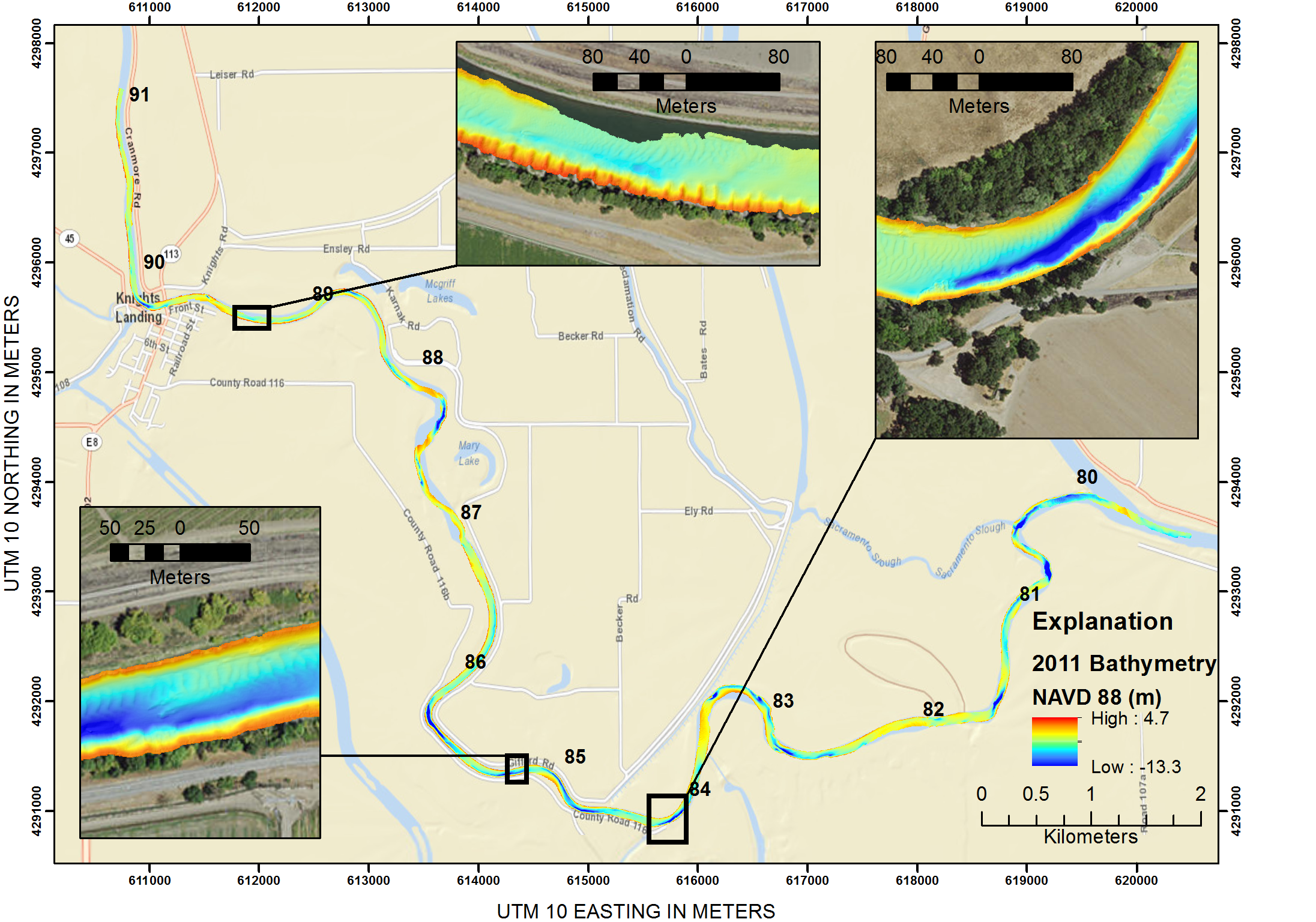
On February 1, 2011, the USGS Pacific Coastal and Marine Science Center (PCMSC) team carried out a project using interferometric sidescan sonar to characterize the riverbed and channel banks of a 12 mile reach of the Sacramento River near the town of Knights Landing, California (River Mile 79 through River Mile 91). The project was developed in coordination with the US Army Corps of Engineers as part of an effort to aid in understanding fish response to the creation of safe habitat associated with levee restoration efforts in two 1.5 mile reaches of the Sacramento River between river mile 80 and 86.
The survey was conducted using the research vessel R/V Parke Snavely outfitted with an interferometric sidescan sonar for swath mapping and Real-Time Kinematic navigation equipment for accurate shallow water operations.
For more information and data, please see the USGS Data Release.
Sources/Usage
Public Domain.
USGS Data Release
Bathymetry and acoustic backscatter data of the Sacramento River, from the Feather River to Knights Landing, California in February, 2011