
San Andreas Fault
Detailed Description
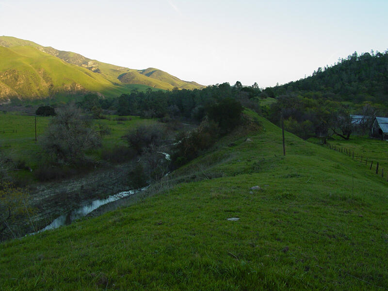
This view shows the San Andreas Fault looking south where Highway 25 crosses the fault (about 7 miles north of the entrance station to the park on the east side of Pinnacles National Monument). The fence basically follows the trace of the fault on the right side of the grassy pressure ridge. The right side is sinking and moving north (toward you) relative to the rising left side of the fault. The San Benito River is on the far left. The San Andreas Fault zone runs along the Highway 25 corridor south of Hollister, California in a valley on the east side of the Gabilan Range. Pinnacles National Monument is located at the southern end of the Gabilan Range (Rymer and others, 2006).
Sources/Usage
Public Domain.