
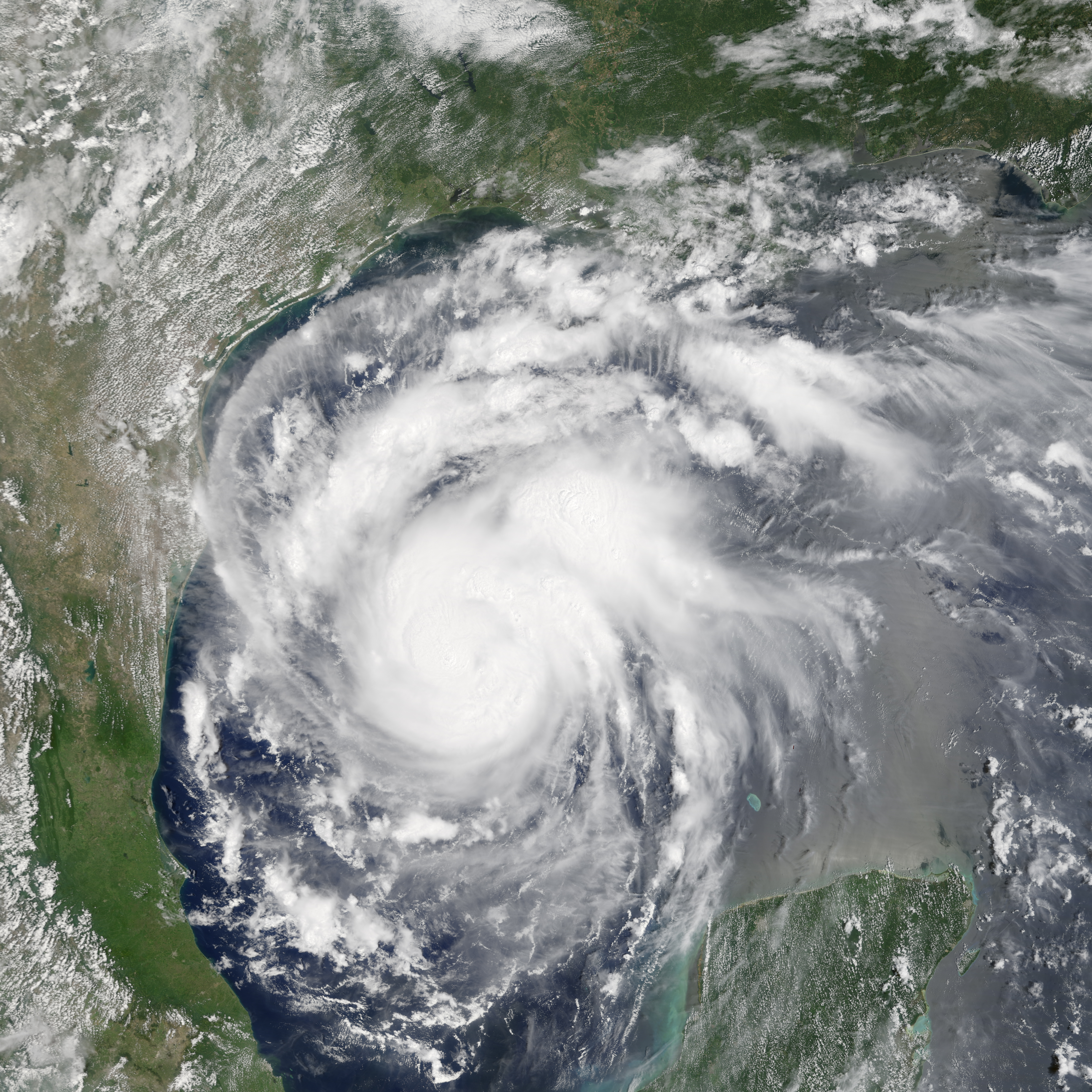
Satellite image of intensifying storm, now Hurricane Harvey

Detailed Description
The Moderate Resolution Imaging Spectroradiometer (MODIS) on NASA’s Terra satellite captured this natural-color image of the rapidly intensifying storm at 11:24 a.m. Central time (16:45 Universal Time) on August 24, 2017. NASA Earth Observatory image by Jesse Allen, using data from the Land Atmosphere Near real-time Capability for EOS (LANCE).
Sources/Usage
Public Domain.