
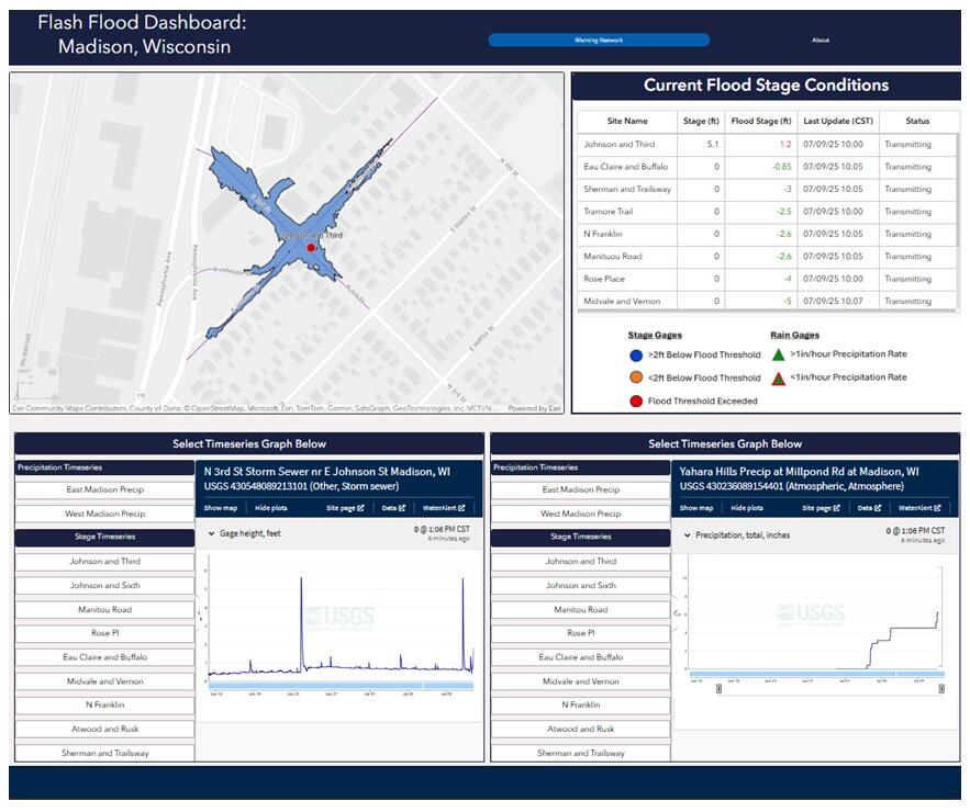
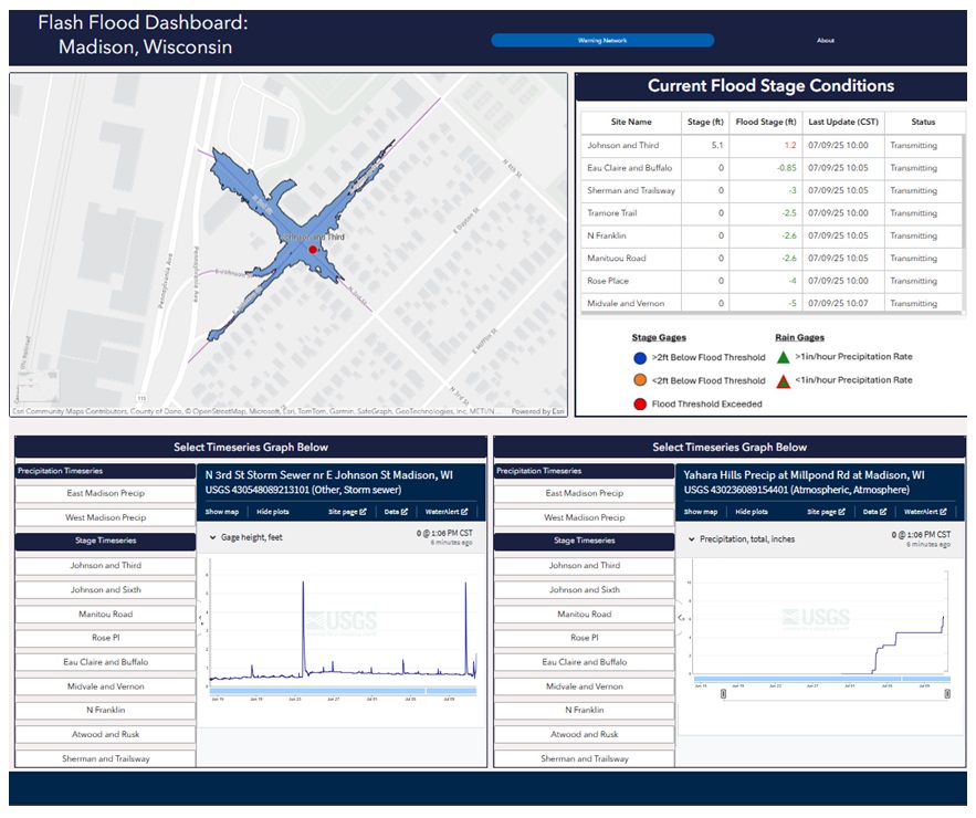
Screenshot of the Madison, Wisconsin Flash Flood Dashboard
By Upper Midwest Water Science Center
January 2026 (approx.)
Detailed Description
Screenshot of the Madison, WI Flash-Flood Dashboard. Water levels are visually displayed into charts, tables, and maps in real-time. Instantaneous values are color-coded to reflect current flood conditions at all monitored locations. Users can zoom in to flooded areas to view the spatial extent of flood waters at the street level.
Sources/Usage
Public Domain.
Related
Low-Cost Sensor Networks for Pluvial Flash Flood Detection and Early Warning in Urban Areas
Flooding in urban areas is a serious weather-related threat to life and property. One type of flooding, called pluvial flooding, occurs during periods of intense rainfall where runoff overwhelms the capacity of soil to absorb it. In urban areas, pluvial flooding can be particularly dangerous because much of a city is covered by impervious surfaces such as streets, roofs, and parking lots forcing...