
Seafloor map of Puerto Rico Trench

Detailed Description
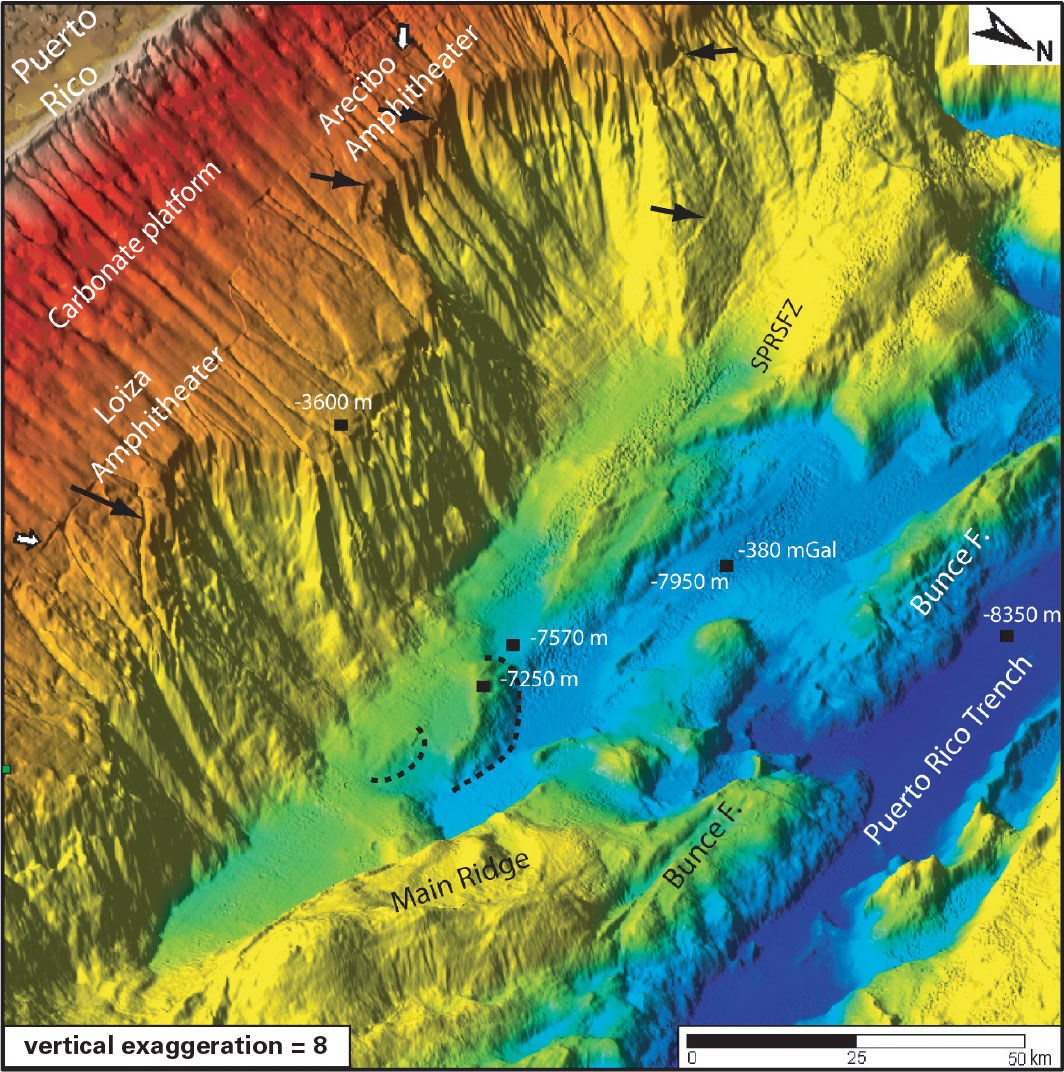
A NOAA image of the bathymetry north of Puerto Rico. Two ancient submarine landslides are visible as head scarps (labeled Loiza and Arecibo Amphitheaters). Seafloor fissures are indicated by black arrows, and dashed lines outline debris flows from past failures. Map annotated by Uri ten Brink, USGS
Sources/Usage
Public Domain.
Improving Earthquake and Tsunami Warnings for the Caribbean Sea, the Gulf of Mexico, and the Atlantic Coast
The magnitude-9 Sumatra-Andaman Islands earthquake of December 26, 2004, increased awareness in the United States of the destructive hazard posed by earthquakes and tsunamis. The U.S. Government, working with international partners, is responding with a real-time system that will significantly improve global earthquake and tsunami monitoring. This fact sheet describes a project for earthquake and tsunami monitoring along a major portion of our vulnerable coastal regions, the Caribbean Sea, the Gulf of Mexico, and the Atlantic Ocean. The project is a result of collaboration between the U.S. Geological Survey and the National Oceanic and Atmospheric Administration (NOAA).