
Seismic record from onset of Kīlauea summit eruption—Sept. 29, 2021
Detailed Description
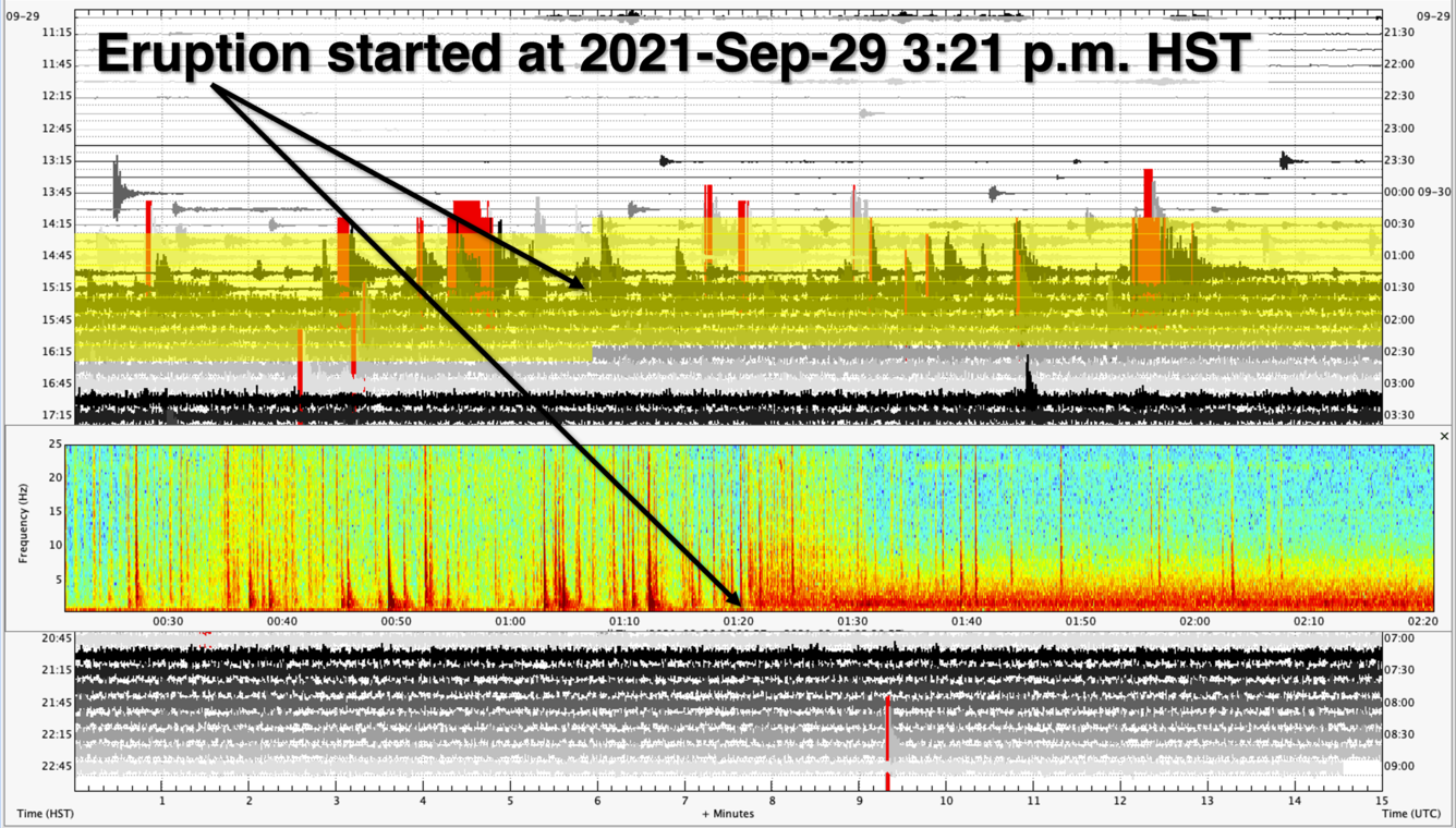
Seismic record from a Kīlauea summit seismic station showing the onset of the new eruption within Halema‘uma‘u. The background image is a webicorder of station RIMD, showing 12 hours of data. Each line shows 15 minutes of seismic data starting from the upper-left corner at 11:00 a.m. HST on September 29, 2021, and ending in the lower-right at 11:00 p.m. HST. The yellow area on this webicorder highlights the 2-hour time period shown in the spectrogram inset. In this inset, warmer colors represent higher energy signals, while the cooler colors show weaker signals. Prior to the start of the eruption, distinct earthquake signals (spikes of red) are visible in the record. Once the eruption began at approximately 3:21 p.m. HST on September 29, 2021, all but a few larger earthquakes have been “drowned-out” by the volcanic tremor (thick band of red at the bottom right-half of the inset) that started with the eruption. USGS figure by J. Chang.
Sources/Usage
Public Domain.