
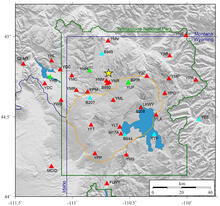
Seismic stations used to located the March 30, 2014, M4.8 Norris quake

Detailed Description
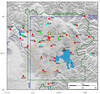
Station map showing seismograph stations used in the location of the M4.8 earthquake that occurred near Norris Geyser Basin on March 30, 2014. The yellow star shows the earthquake epicenter. Red triangles represent seismograph stations with a P-wave arrival pick. Green triangles represent seismograph stations with both a P-wave and a S-wave arrival pick. Cyan triangles represent seismograph stations that were not used in the location.
Sources/Usage
Public Domain.