ShakeAlert—Earthquake Early Warning System for the US Western States

Detailed Description
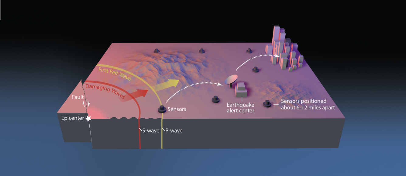
Earthquake early warning systems like ShakeAlert work because the warning message can be transmitted almost instantaneously, while shaking waves from the earthquake travel through the Earth at speeds of a few miles per second. When an earthquake occurs, seismic waves—including compressional (P) waves, transverse (S) waves, and surface waves—radiate outward from the epicenter. The faster but weaker P waves trip nearby sensors, causing alert signals to be sent out, giving people and automated electronic systems some time (seconds to minutes) to take protective actions before the arrival of the slower but stronger S waves and surface waves. Computers and mobile phones receiving the alert message can calculate the expected arrival time and intensity of shaking at your location. USGS image created by Erin Burkett (USGS) and Jeff Goertzen (Orange County Register).
Sources/Usage
Public Domain.
ShakeAlert—An earthquake early warning system for the United States west coast
Abstract
First posted August 29, 2014
Revised February 8, 2017
For additional information, contact:
Earthquake Science Center—Menlo Park, Calif. Office
U.S. Geological Survey
345 Middlefield Road, MS 977
Menlo Park, CA 94025
Earthquake early warning systems use earthquake science and the technology of monitoring systems to alert devices and people when shaking waves generated by an earthquake are expected to arrive at their location. The seconds to minutes of advance warning can allow people and systems to take actions to protect life and property from destructive shaking. The U.S. Geological Survey (USGS), in collaboration with several partners, has been working to develop an early warning system for the United States. ShakeAlert, a system currently under development, is designed to cover the West Coast States of California, Oregon, and Washington.

