Slow slip event on Kīlauea's south flank is expected this year

Detailed Description
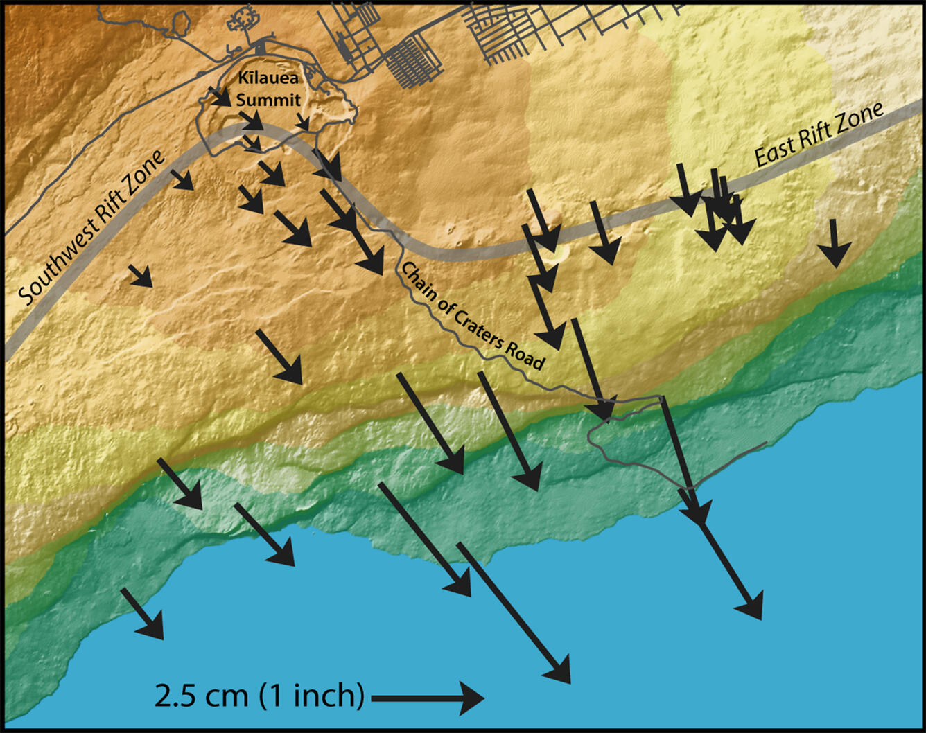
Black arrows indicate the amount and direction of motion measured by GPS stations in HVO's monitoring network during the October 2015 slow slip event. Arrow lengths correspond to the amount of motion at each station (see scale at bottom of map); arrow points show the direction the stations moved. Color indicates topography, from sea level (green) to 4,000 feet elevation (brown). The ocean is shown in blue. USGS graphic.
Sources/Usage
Public Domain.

