
Spectroscopic alteration map; minerals; Cuprite, Nevada
By Geology, Geophysics, and Geochemistry Science Center
2014 (approx.)
Detailed Description
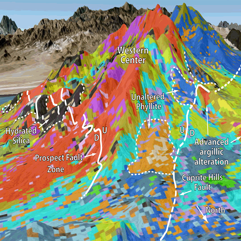
Mineral maps based on Airborne Visible/Infrared Imaging Spectrometer (AVIRIS) data were used to study late Miocene advanced argillic alteration at Cuprite, Nevada. Distributions of Fe-bearing minerals, clays, micas, sulfates, and carbonates were mapped using the Tetracorder spectral-shape matching system.
Sources/Usage
Public Domain.
Mapping Advanced Argillic Alteration at Cuprite, Nevada Using Imaging Spectroscopy, Figure 17
Swayze, G.A., R.N. Clark, A.F.H. Goetz, K.E. Livo, G.N. Breit, F.A. Kruse, S.J. Stutley, L.W. Snee, H.A. Lowers, J.L. Post, R.E. Stoffregen, and R.P. Ashley, 2014, Mapping advanced argillic alteration at Cuprite, Nevada using imaging spectroscopy: Economic Geology, v. 109, no. 5, p. 1179-1221. doi:10.2113/econgeo.109.5.1179