
Statewide Evapotranspiration Estimation in Florida
Detailed Description
Project Title: Statewide Evapotranspiration Estimation in Florida using Field Data, Satellites and Weather Models
Principle Investigator: W. Barclay Shoemaker
Other contributors: Water managers in Florida
Description:
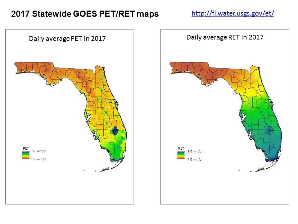
- Evapotranspiration (ET) estimates are essential for all aspects of water management, including agricultural water-use estimation, permitting, research, regulation, and planning.
- The USGS Caribbean-Florida Water Science Center initiated a multi-year project in FY 2006 to create spatially-continuous, high-resolution evapotranspiration (ET) maps for the entire State of Florida in cooperation with the Suwannee River, Northwest Florida, St. Johns River, Southwest Florida and South Florida Water Management Districts (WMDs).
- The goal of the project was to create potential (PET) and reference (RET) ET maps in Florida that were spatially continuous and computed with consistent methodology.
Image provided by: W. Barclay Shoemaker, Caribbean-Florida Water Science Center for use on the Advanced Research and Computing site.
Sources/Usage
Public Domain.