
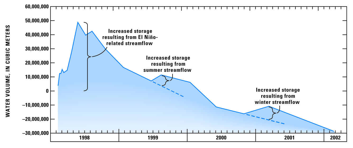
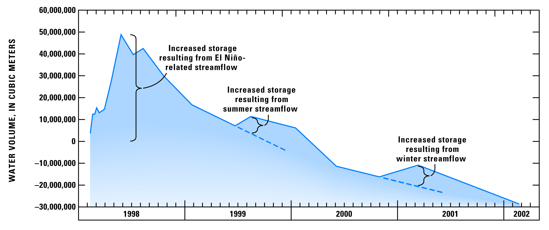
Storage changes measured along Rillito Creek, AZ, December 1997
By Arizona Water Science Center
2007 (approx.)
Detailed Description
Graph showing storage changes along Rillito Creek, Pima County, Arizona, from Craycroft Road to La Cholla Boulevard relative to a measurement made in December 1997 (Hoffmann and other, 2007)
Sources/Usage
Public Domain.
U.S. Geological Survey, Professional Paper 1703-H
Hoffmann, J.P., Blasch, K.W., Pool, D.R., Bailey, M.A., and Callegary, J.B., 2007, Estimated infiltration, percolation, and recharge rates at the Rillito Creek focused recharge investigation site, Pima County, Arizona, in Stonestrom, D.A., Constantz, J., Ferré, T.P.A., and Leake, S.A., eds., Ground-water recharge in the arid and semiarid southwestern United States: U.S. Geological Survey Professional Paper 1703-H, p. 185–220