
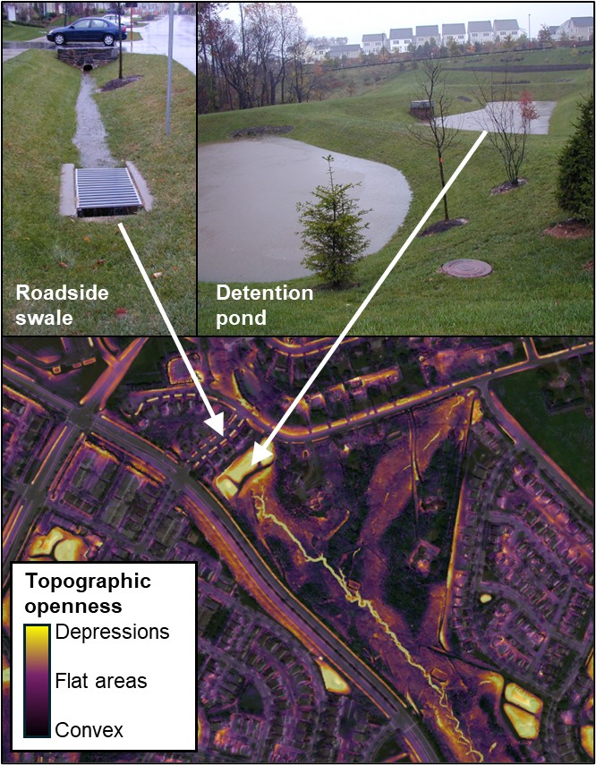
Stormwater follows through a roadside swale and stormwater detention pond in Clarksburg, Maryland
By Chesapeake Bay Activities
2025 (approx.)

Detailed Description
Stormwater follows through a roadside swale and stormwater detention pond in Clarksburg, Maryland. These stormwater features are visible as depressions on a geospatial dataset called topographic openness. Topographic openness measures how open (flat) or closed (depression) a feature is.
Sources/Usage
Public Domain.
Related
Remotely mapping stormwater facility footprints and storage volumes
Stormwater management practices are being used throughout the Chesapeake Bay watershed to reduce flood risks and pollutant loads, but consistent and comprehensive maps of these practices are often lacking. Stormwater managers often have incomplete information about the location and storage volume of stormwater facilities within their jurisdiction. Therefore, the USGS is working to develop...