
Surface Elevation Table
By Wetland and Aquatic Research Center
2009 (approx.)

Detailed Description
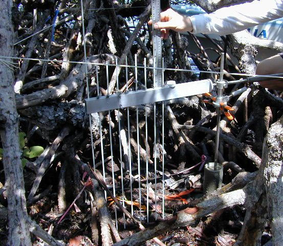
A Surface Elevation Table (SET) is used to track changes in soil elevations on mangrove islands. As peat forms, the soil surface expands upward, allowing mangroves to keep up with rising sea level.
Sources/Usage
Public Domain.