
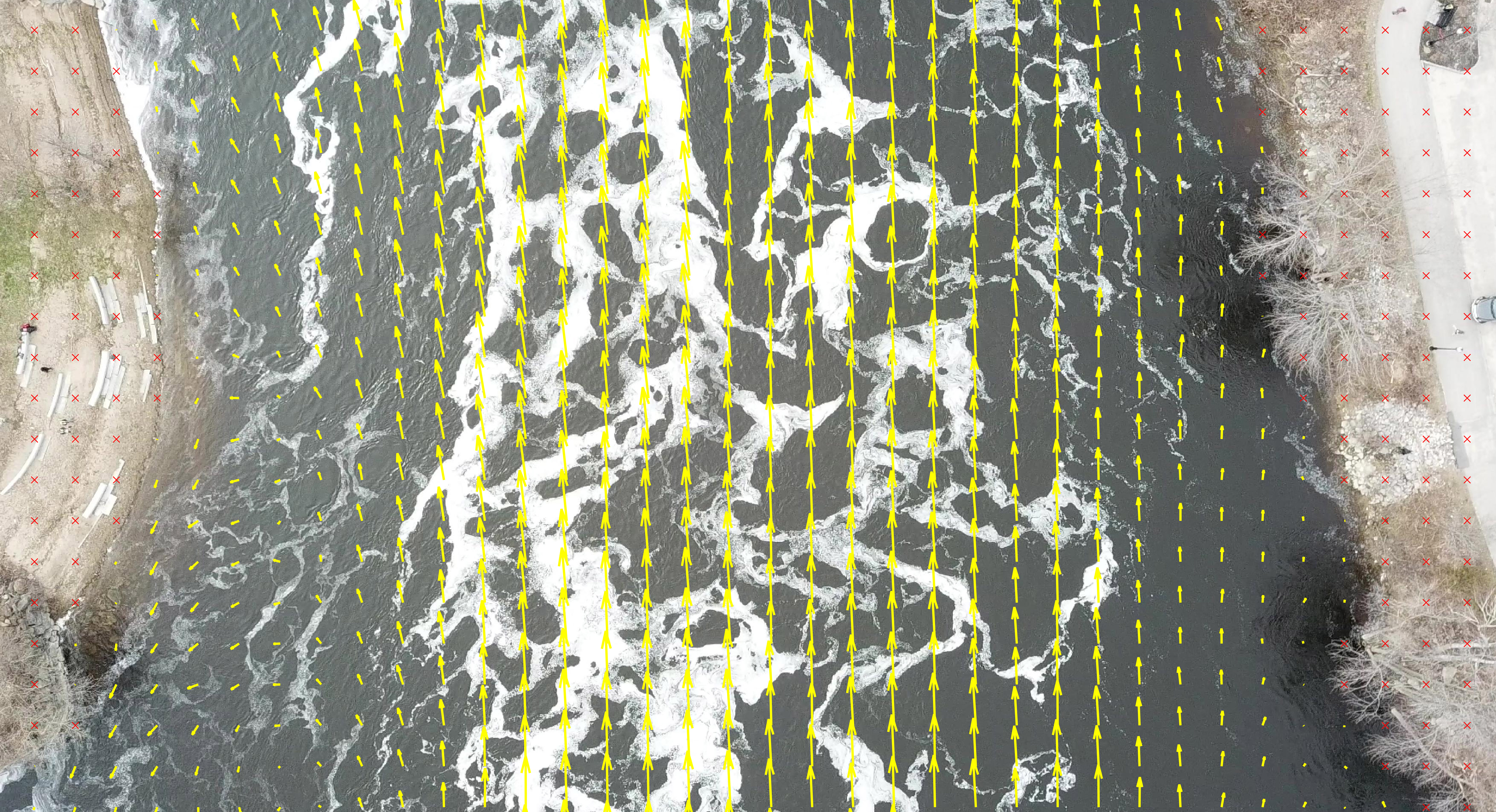
Surface velocity for the Androscoggin River, ME

Detailed Description
A motion-stabilized UAS-derived average two-dimensional surface velocity field result for the Androscoggin River, Auburn, Maine on May 1, 2019. Yellow arrows depict relative surface velocity magnitudes and directions. Red "X"s depict areas excluded from analysis (ground). UAS data were collected as part of the 2019 Airshow breakthrough demonstration of river discharge measurements made by drone.
Sources/Usage
Public Domain.