
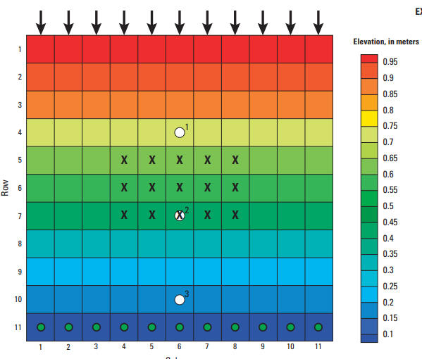
Surface-Water Routing Example Model Grid
Detailed Description
Model grid showing the elevation of the top of the model (which can be considered to be the bathymetry of the shallow-water system), the location of boundary conditions, and the location of observations used in an example simulation.
Sources/Usage
Public Domain.