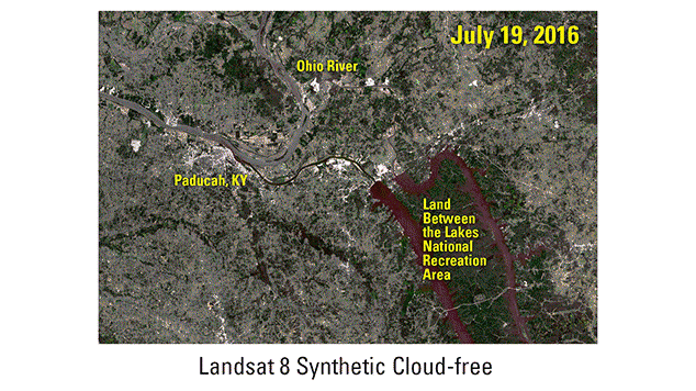
Synthetic Landsat data to LANDFIRE animation

Detailed Description
Animation showing synthetic Landsat imagery alongside a LANDFIRE-derived land cover map of the Paducah, KY area.
Sources/Usage
Public Domain.

Official websites use .gov
A .gov website belongs to an official government organization in the United States.
Secure .gov websites use HTTPS
A lock () or https:// means you’ve safely connected to the .gov website. Share sensitive information only on official, secure websites.
Animation showing synthetic Landsat imagery alongside a LANDFIRE-derived land cover map of the Paducah, KY area.
Public Domain.