
Tar River Basin Flood-Inundation Mapping Sites, N.C.
Detailed Description
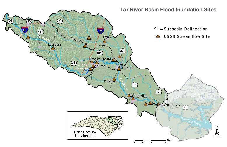
Tar River Basin, N.C., Flood-Inundation Mapping
In cooperation with the North Carolina Division of Emergency Management, Floodplain Mapping Program, the U.S. Geological Survey (USGS) has created flood-inundation maps for selected streamgage sites in the Tar River basin. These maps depict the approximate area that would be inundated at selected water levels, ranging from approximately top-of-bank to the maximum observed water level. The inundated areas depicted on these maps are approximate, and accuracy of the maps is a function of the accuracy of the topographic data and the hydraulic models on which the maps are based.
—► Go to the Tar River Basin Flood-Inundation Mapping Web site