
Tassel Cap Planes for Landsat MSS and TM images

Detailed Description
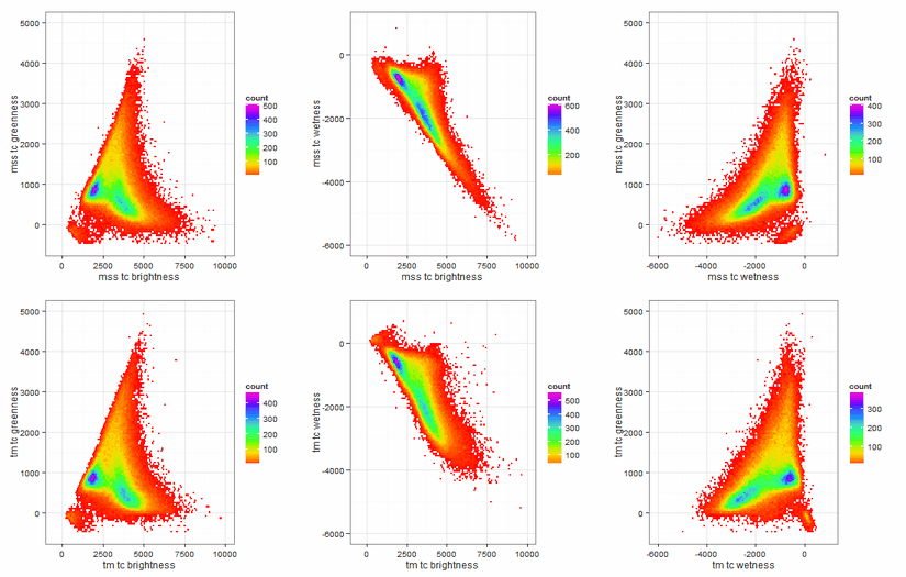
The top row of this image shows the Tassel Cap (TC) planes for a Landat MSS image, while the bottom row are the TC planes for the coincident TM image. The distribution of pixel values between the images for each TC plane are very similar. The greatest deviation is for TC wetness, which is heavily weighted by short-wave infrared, which MSS data does not contain (is it modeled in the LLR process).
Visit this Landsat In Action web page for more information.
Sources/Usage
Public Domain.