
Topobathymetric Elevation Model Southeast of New Orleans, Louisiana
Detailed Description
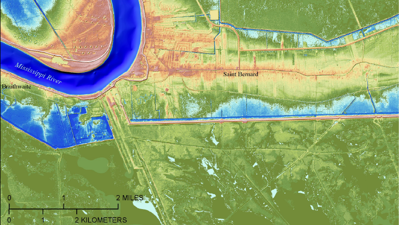
Example of topobathymetric elevation model for an area along the Mississippi River southeast of New Orleans, Louisiana.
See the Coastal National Elevation Database (CoNED) Applications Project page for more information.
Sources/Usage
Public Domain.
Related

Topobathymetric Elevation Model of Northern Gulf of America
Accurate, high-resolution elevation information is vital to understanding the highly dynamic northern Gulf of America coast, the location of North America’s largest delta system and the focus of one of the largest coastal restoration and flood risk reduction efforts in the United States. The northern Gulf of America topobathymetric digital elevation model (TBDEM) was developed in collaboration...
Related
Topobathymetric Elevation Model of Northern Gulf of America
Accurate, high-resolution elevation information is vital to understanding the highly dynamic northern Gulf of America coast, the location of North America’s largest delta system and the focus of one of the largest coastal restoration and flood risk reduction efforts in the United States. The northern Gulf of America topobathymetric digital elevation model (TBDEM) was developed in collaboration...