
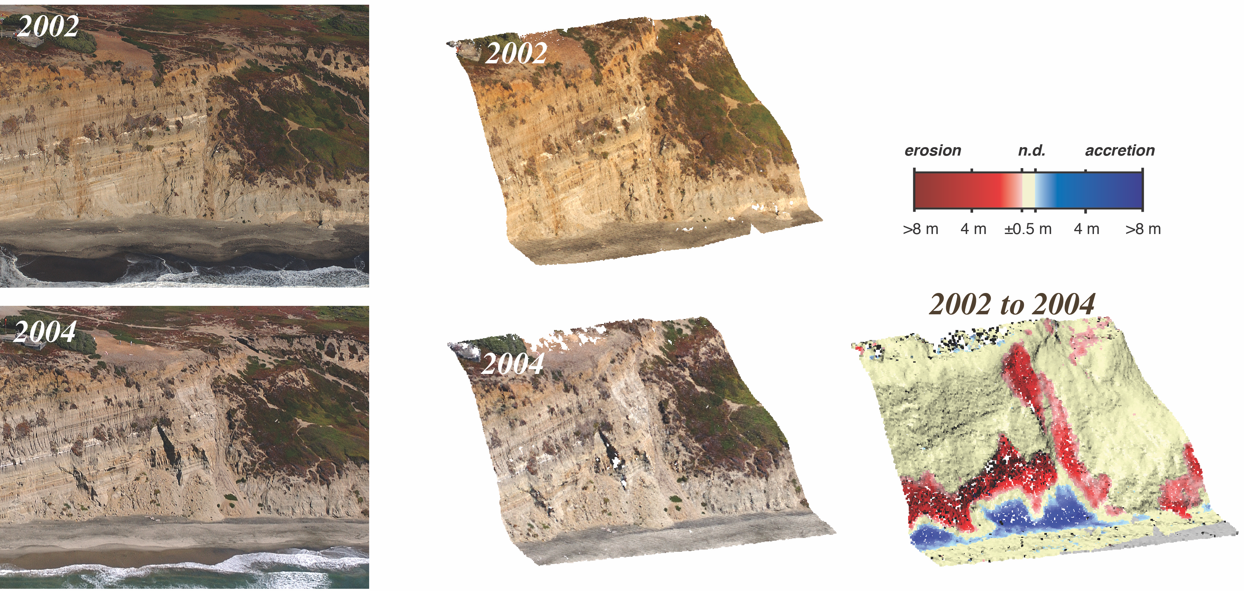
Topographic changes caused landslide from coastal cliff

Detailed Description
Topographic changes caused by the second-largest landslide in the Fort Funston study area between 2002 and 2004, as measured with structure-from-motion analysis. Original California Coastal Record Project photographs at left, topographic point clouds from structure-from-motion analysis in center, and difference map showing degree of erosion and deposition between years 2002 and 2004 on right.